Toki elevation
Toki (Gifu, Toki-shi), Japan elevation is 159 meters and Toki elevation in feet is 522 ft above sea level [src 1]. Toki is a seat of a second-order administrative division (feature code) with elevation that is 74 meters (243 ft) bigger than average city elevation in Japan.
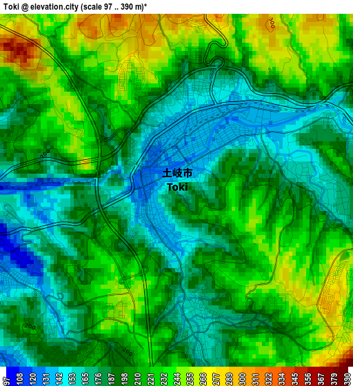
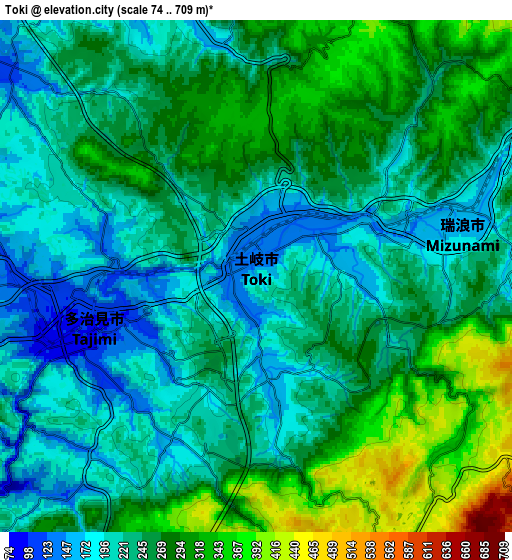
Below is the Elevation map of Toki, which displays elevation range with different colors. Scale of the first map is from 97 to 390 m (318 to 1280 ft) with average elevation of 203 meters (=666 ft) [note 1]
These maps also provides idea of topography and contour of this city, they are displayed at different zoom levels. More info about maps, scale and edge coordinates you can find below images.
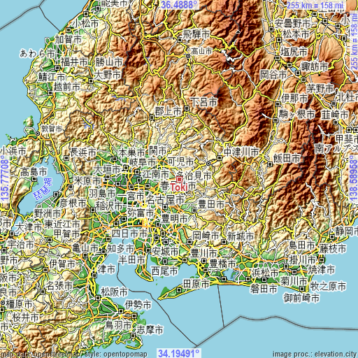
| \ | Map #1 | Map #2 | Topo.Map |
| Scale [m] | 97..390 m | 74..709 m | × |
| Scale [ft] | 318..1280 ft | 243..2326 ft | × |
| Average | 203 m = 666 ft | 250.4 m = 822 ft | × |
| Width | 7.97 km = 5 mi | 15.94 km = 9.9 mi | 255.1 km = 158.5 mi |
| Height | 7.97 km = 5 mi | 15.94 km = 9.9 mi | 255.1 km = 158.5 mi |
| ↑Max Latitude | 35.385835° | 35.421655° | 36.4888° |
| Latitude at center | 35.35° | 35.35° | 35.35° |
| ↓Min Latitude | 35.314149° | 35.278282° | 34.19491° |
| ← Min Longitude | 137.139385° | 137.095439° | 135.77708° |
| Longitude center | 137.18333° | 137.18333° | 137.18333° |
| →Max Longitude | 137.227275° | 137.271221° | 138.58958° |
Nearby cities:
Cities around Toki sort by population:
• Kasugai elevation 30 m
22.3 km,  239°
239°
• Komaki 17 m
25.3 km,  252°
252°
• Seto 111 m
15 km,  210°
210°
• Tajimi 138 m
5.9 km,  230°
230°
• Inuyama 56 m
22 km,  278°
278°
• Minokamo 175 m
20.7 km,  315°
315°
• Mizunami 157 m
6.3 km,  72°
72°
• Mitake 232 m
8.7 km,  328°
328°
• Nisshin 45 m
26.5 km, 206°
• Nagakute 85 m
22.8 km, 210°
• Ena 358 m
21.1 km,  59°
59°
• Kani 123 m
13 km,  297°
297°
Multilingual:
 En español:
Toki elevación 159 m.
 En France:
Toki élévation 159 m.


Sources and notes:
- [note 1] Map square and city borders are not equal. Map elevation data is calculated only from area inside that square.
- [src 1] Elevation data from geonames database provided with same terms of usage.
- [src 2] The elevation map of Toki is generated using elevation data from NASA's 3 arcsec (90m) resolution SRTM data.
- [src 3] Base (background) map © OpenStreetMap contributors tiles are generated by Geofabrik and OpenTopoMap.
Copyright & License:
This Toki Elevation Map is licensed under CC BY-SA. You may reuse any part from this page, if you give a proper credit by linking to this URL:
 More info on terms of use page.