Inuyama elevation
Inuyama (Aichi, Inuyama-shi), Japan elevation is 56 meters and Inuyama elevation in feet is 184 ft above sea level [src 1]. Inuyama is a seat of a second-order administrative division (feature code) with elevation that is 29 meters (95 ft) smaller than average city elevation in Japan.
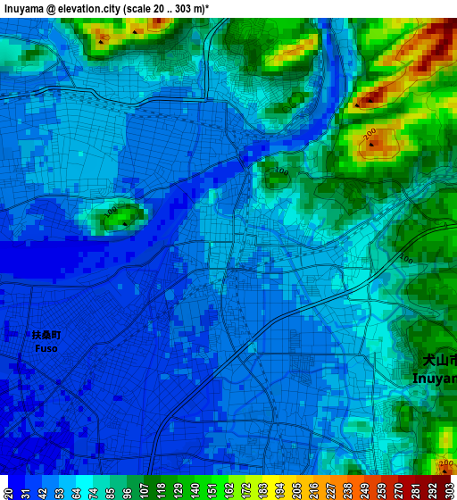
Below is the Elevation map of Inuyama, which displays elevation range with different colors. Scale of the first map is from 20 to 303 m (66 to 994 ft) with average elevation of 71 meters (=233 ft) [note 1]
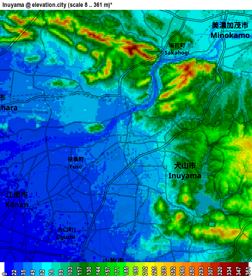
These maps also provides idea of topography and contour of this city, they are displayed at different zoom levels. More info about maps, scale and edge coordinates you can find below images.
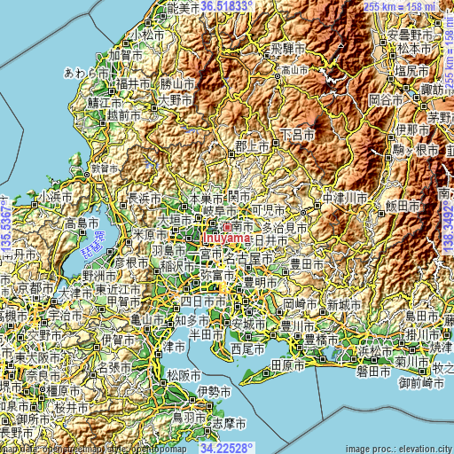
| \ | Map #1 | Map #2 | Topo.Map |
| Scale [m] | 20..303 m | 8..361 m | × |
| Scale [ft] | 66..994 ft | 26..1184 ft | × |
| Average | 71 m = 233 ft | 83.3 m = 273 ft | × |
| Width | 7.97 km = 5 mi | 15.94 km = 9.9 mi | 255 km = 158.4 mi |
| Height | 7.97 km = 5 mi | 15.94 km = 9.9 mi | 255 km = 158.4 mi |
| ↑Max Latitude | 35.415772° | 35.451578° | 36.51833° |
| Latitude at center | 35.37995° | 35.37995° | 35.37995° |
| ↓Min Latitude | 35.344112° | 35.308258° | 34.22528° |
| ← Min Longitude | 136.899005° | 136.855059° | 135.5367° |
| Longitude center | 136.94295° | 136.94295° | 136.94295° |
| →Max Longitude | 136.986895° | 137.030841° | 138.3492° |
Nearby cities:
Cities around Inuyama sort by population:
• Kasugai elevation 30 m
15 km,  169°
169°
• Ichinomiya 11 m
15.7 km,  235°
235°
• Komaki 17 m
11 km,  192°
192°
• Kakamigahara 40 m
8 km,  300°
300°
• Kōnan 19 m
8.5 km,  230°
230°
• Minokamo 175 m
13.4 km,  32°
32°
• Iwakura 11 m
12.8 km,  212°
212°
• Kuroda 10 m
14.9 km,  257°
257°
• Kasamatsuchō 4 m
16.1 km, 264°
• Kitanagoya 15 m
15.9 km,  201°
201°
• Sekimachi 51 m
11.7 km,  348°
348°
• Kani 123 m
10.6 km,  75°
75°
Multilingual:
 En español:
Inuyama elevación 56 m.
 En France:
Inuyama élévation 56 m.


Sources and notes:
- [note 1] Map square and city borders are not equal. Map elevation data is calculated only from area inside that square.
- [src 1] Elevation data from geonames database provided with same terms of usage.
- [src 2] The elevation map of Inuyama is generated using elevation data from NASA's 3 arcsec (90m) resolution SRTM data.
- [src 3] Base (background) map © OpenStreetMap contributors tiles are generated by Geofabrik and OpenTopoMap.
Copyright & License:
This Inuyama Elevation Map is licensed under CC BY-SA. You may reuse any part from this page, if you give a proper credit by linking to this URL:
 More info on terms of use page.