Cereda-Cozza Cornedo elevation
Cereda-Cozza Cornedo (Veneto, Provincia di Vicenza), Italy elevation is 166 meters and Cereda-Cozza Cornedo elevation in feet is 545 ft above sea level [src 1]. Cereda-Cozza Cornedo is a populated place (feature code) with elevation that is 156 meters (512 ft) smaller than average city elevation in Italy.
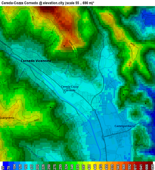
Below is the Elevation map of Cereda-Cozza Cornedo, which displays elevation range with different colors. Scale of the first map is from 55 to 690 m (180 to 2264 ft) with average elevation of 258.8 meters (=849 ft) [note 1]
These maps also provides idea of topography and contour of this city, they are displayed at different zoom levels. More info about maps, scale and edge coordinates you can find below images.
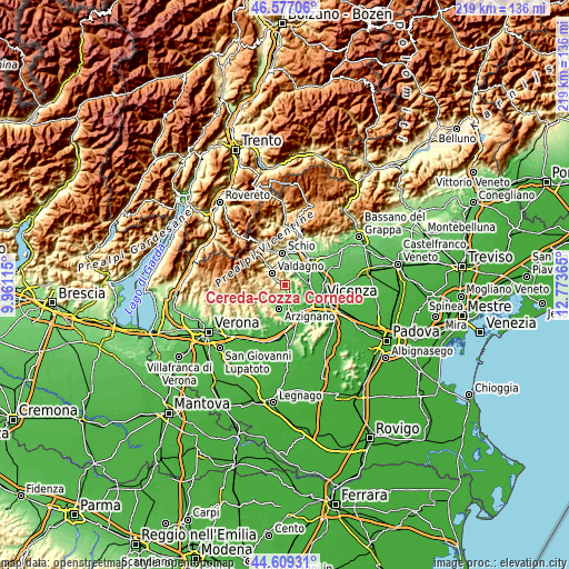
| \ | Map #1 | Topo.Map |
| Scale [m] | 55..690 m | × |
| Scale [ft] | 180..2264 ft | × |
| Average | 258.8 m = 849 ft | × |
| Width | 6.84 km = 4.3 mi | 218.8 km = 136 mi |
| Height | 6.84 km = 4.3 mi | 218.8 km = 136 mi |
| ↑Max Latitude | 45.632548° | 46.57706° |
| Latitude at center | 45.60181° | 45.60181° |
| ↓Min Latitude | 45.571056° | 44.60931° |
| ← Min Longitude | 11.323455° | 9.96115° |
| Longitude center | 11.3674° | 11.3674° |
| →Max Longitude | 11.411345° | 12.77365° |
Nearby cities:
Cities around Cereda-Cozza Cornedo sort by population:
• Valdagno elevation 269 m
7.2 km,  312°
312°
• Malo 113 m
7.4 km,  30°
30°
• Cornedo Vicentino 201 m
3.2 km,  300°
300°
• Trissino 121 m
4.7 km,  171°
171°
• Isola Vicentina 75 m
6.8 km,  63°
63°
• Castelgomberto 141 m
2.8 km,  140°
140°
• Castelnovo 65 m
7.3 km,  77°
77°
• Brogliano 173 m
1.4 km,  186°
186°
• Tezze 96 m
7.5 km,  178°
178°
• Monte di Malo 377 m
6.5 km,  355°
355°
• Nogarole Vicentino 524 m
7.7 km,  233°
233°
• Gambugliano 147 m
5.7 km,  105°
105°
Multilingual:
 En español:
Cereda-Cozza Cornedo elevación 166 m.
 En France:
Cereda-Cozza Cornedo élévation 166 m.
 Auf Deutsch:
Cereda-Cozza Cornedo höhe über dem Meeresspiegel ist 166 m.
 На русском:
Cereda-Cozza Cornedo высота над уровнем моря 166 м
Sources and notes:
- [note 1] Map square and city borders are not equal. Map elevation data is calculated only from area inside that square.
- [src 1] Elevation data from geonames database provided with same terms of usage.
- [src 2] The elevation map of Cereda-Cozza Cornedo is generated using elevation data from NASA's 3 arcsec (90m) resolution SRTM data.
- [src 3] Base (background) map © OpenStreetMap contributors tiles are generated by Geofabrik and OpenTopoMap.
Copyright & License:
This Cereda-Cozza Cornedo Elevation Map is licensed under CC BY-SA. You may reuse any part from this page, if you give a proper credit by linking to this URL:
 More info on terms of use page.