Castelgomberto elevation
Castelgomberto (Veneto, Provincia di Vicenza), Italy elevation is 141 meters and Castelgomberto elevation in feet is 463 ft above sea level [src 1]. Castelgomberto is a seat of a third-order administrative division (feature code) with elevation that is 181 meters (594 ft) smaller than average city elevation in Italy.
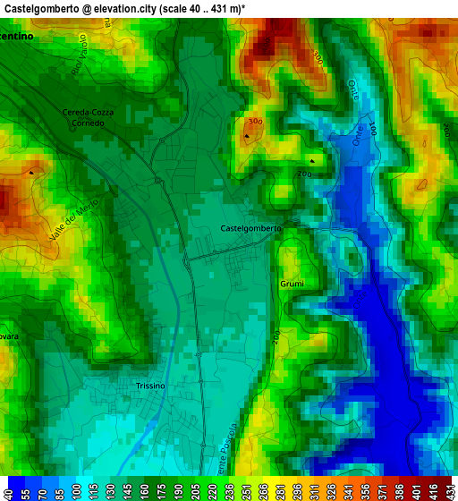
Below is the Elevation map of Castelgomberto, which displays elevation range with different colors. Scale of the first map is from 40 to 431 m (131 to 1414 ft) with average elevation of 175.8 meters (=577 ft) [note 1]
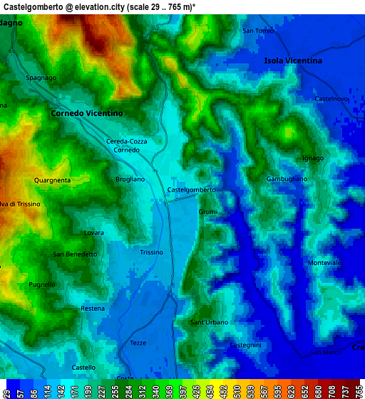
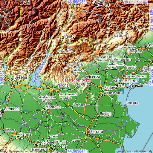
These maps also provides idea of topography and contour of this city, they are displayed at different zoom levels. More info about maps, scale and edge coordinates you can find below images.
| \ | Map #1 | Map #2 | Topo.Map |
| Scale [m] | 40..431 m | 29..765 m | × |
| Scale [ft] | 131..1414 ft | 95..2510 ft | × |
| Average | 175.8 m = 577 ft | 205.3 m = 674 ft | × |
| Width | 6.84 km = 4.3 mi | 13.68 km = 8.5 mi | 218.9 km = 136 mi |
| Height | 6.84 km = 4.3 mi | 13.68 km = 8.5 mi | 218.9 km = 136 mi |
| ↑Max Latitude | 45.613418° | 45.644149° | 46.55825° |
| Latitude at center | 45.58267° | 45.58267° | 45.58267° |
| ↓Min Latitude | 45.551905° | 45.521123° | 44.58984° |
| ← Min Longitude | 11.346125° | 11.302179° | 9.98382° |
| Longitude center | 11.39007° | 11.39007° | 11.39007° |
| →Max Longitude | 11.434015° | 11.477961° | 12.79632° |
Nearby cities:
Cities around Castelgomberto sort by population:
• Arzignano elevation 117 m
8.2 km,  211°
211°
• Cornedo Vicentino 201 m
5.8 km,  309°
309°
• Trissino 121 m
2.7 km,  202°
202°
• Isola Vicentina 75 m
6.8 km,  40°
40°
• Sovizzo 45 m
7.6 km,  144°
144°
• Castelnovo 65 m
6.5 km,  55°
55°
• Costabissara 47 m
7.4 km,  90°
90°
• Brogliano 173 m
2 km,  290°
290°
• Tezze 96 m
5.6 km, 196°
• Cereda-Cozza Cornedo 166 m
2.8 km,  320°
320°
• Monteviale 156 m
5.8 km,  116°
116°
• Gambugliano 147 m
3.8 km,  81°
81°
Multilingual:
 En español:
Castelgomberto elevación 141 m.
 En France:
Castelgomberto élévation 141 m.
 Auf Deutsch:
Castelgomberto höhe über dem Meeresspiegel ist 141 m.

Sources and notes:
- [note 1] Map square and city borders are not equal. Map elevation data is calculated only from area inside that square.
- [src 1] Elevation data from geonames database provided with same terms of usage.
- [src 2] The elevation map of Castelgomberto is generated using elevation data from NASA's 3 arcsec (90m) resolution SRTM data.
- [src 3] Base (background) map © OpenStreetMap contributors tiles are generated by Geofabrik and OpenTopoMap.
Copyright & License:
This Castelgomberto Elevation Map is licensed under CC BY-SA. You may reuse any part from this page, if you give a proper credit by linking to this URL:
 More info on terms of use page.