Arzignano elevation
Arzignano (Veneto, Provincia di Vicenza), Italy elevation is 117 meters and Arzignano elevation in feet is 384 ft above sea level [src 1]. Arzignano is a seat of a third-order administrative division (feature code) with elevation that is 205 meters (673 ft) smaller than average city elevation in Italy.
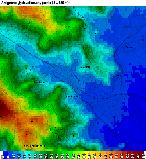
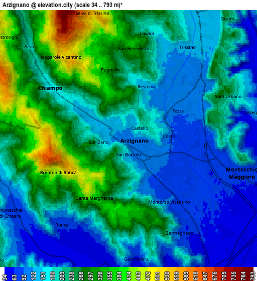
Below is the Elevation map of Arzignano, which displays elevation range with different colors. Scale of the first map is from 68 to 585 m (223 to 1919 ft) with average elevation of 197.2 meters (=647 ft) [note 1]
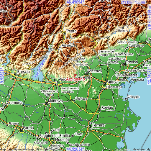
These maps also provides idea of topography and contour of this city, they are displayed at different zoom levels. More info about maps, scale and edge coordinates you can find below images.
| \ | Map #1 | Map #2 | Topo.Map |
| Scale [m] | 68..585 m | 34..793 m | × |
| Scale [ft] | 223..1919 ft | 112..2602 ft | × |
| Average | 197.2 m = 647 ft | 208.9 m = 685 ft | × |
| Width | 6.85 km = 4.3 mi | 13.69 km = 8.5 mi | 219.1 km = 136.1 mi |
| Height | 6.85 km = 4.3 mi | 13.69 km = 8.5 mi | 219.1 km = 136.1 mi |
| ↑Max Latitude | 45.551052° | 45.581817° | 46.49694° |
| Latitude at center | 45.52027° | 45.52027° | 45.52027° |
| ↓Min Latitude | 45.489471° | 45.458655° | 44.52634° |
| ← Min Longitude | 11.290515° | 11.246569° | 9.92821° |
| Longitude center | 11.33446° | 11.33446° | 11.33446° |
| →Max Longitude | 11.378405° | 11.422351° | 12.74071° |
Nearby cities:
Cities around Arzignano sort by population:
• Montecchio Maggiore-Alte Ceccato elevation 71 m
6.3 km,  106°
106°
• Chiampo 214 m
5 km,  306°
306°
• Trissino 121 m
5.5 km,  36°
36°
• Gambellara 55 m
6.7 km,  176°
176°
• San Giovanni Ilarione 168 m
7.6 km,  269°
269°
• Montecchia di Crosara 80 m
7.6 km,  235°
235°
• Montorso Vicentino 86 m
3.8 km,  148°
148°
• Tezze 96 m
3.2 km,  61°
61°
• Roncà 75 m
5.5 km,  215°
215°
• Zermeghedo 62 m
5.8 km, 147°
• Terrossa 49 m
6.4 km,  191°
191°
• Nogarole Vicentino 524 m
5.7 km,  320°
320°
Multilingual:
 En español:
Arzignano elevación 117 m.
 En France:
Arzignano élévation 117 m.
 Auf Deutsch:
Arzignano höhe über dem Meeresspiegel ist 117 m.

Sources and notes:
- [note 1] Map square and city borders are not equal. Map elevation data is calculated only from area inside that square.
- [src 1] Elevation data from geonames database provided with same terms of usage.
- [src 2] The elevation map of Arzignano is generated using elevation data from NASA's 3 arcsec (90m) resolution SRTM data.
- [src 3] Base (background) map © OpenStreetMap contributors tiles are generated by Geofabrik and OpenTopoMap.
Copyright & License:
This Arzignano Elevation Map is licensed under CC BY-SA. You may reuse any part from this page, if you give a proper credit by linking to this URL:
 More info on terms of use page.