Donato elevation
Donato (Piedmont, Provincia di Biella), Italy elevation is 690 meters and Donato elevation in feet is 2264 ft above sea level [src 1]. Donato is a seat of a third-order administrative division (feature code) with elevation that is 368 meters (1207 ft) bigger than average city elevation in Italy.
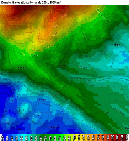
Below is the Elevation map of Donato, which displays elevation range with different colors. Scale of the first map is from 259 to 1585 m (850 to 5200 ft) with average elevation of 717.8 meters (=2355 ft) [note 1]
These maps also provides idea of topography and contour of this city, they are displayed at different zoom levels. More info about maps, scale and edge coordinates you can find below images.
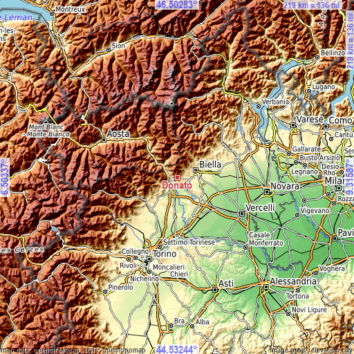
| \ | Map #1 | Topo.Map |
| Scale [m] | 259..1585 m | × |
| Scale [ft] | 850..5200 ft | × |
| Average | 717.8 m = 2355 ft | × |
| Width | 6.85 km = 4.3 mi | 219.1 km = 136.1 mi |
| Height | 6.85 km = 4.3 mi | 219.1 km = 136.1 mi |
| ↑Max Latitude | 45.557039° | 46.50283° |
| Latitude at center | 45.52626° | 45.52626° |
| ↓Min Latitude | 45.495464° | 44.53244° |
| ← Min Longitude | 7.865675° | 6.50337° |
| Longitude center | 7.90962° | 7.90962° |
| →Max Longitude | 7.953565° | 9.31587° |
Nearby cities:
Cities around Donato sort by population:
• Montalto Dora elevation 250 m
5.5 km,  222°
222°
• Borgofranco d'Ivrea 256 m
4.1 km,  254°
254°
• Cascinette d'Ivrea 244 m
5.1 km,  183°
183°
• Chiaverano 316 m
3.1 km,  190°
190°
• Burolo 277 m
5.4 km,  159°
159°
• Graglia 596 m
6.5 km,  56°
56°
• Netro 566 m
3.3 km, 62°
• Sala Biellese 611 m
4.3 km,  117°
117°
• Andrate 788 m
2.2 km,  270°
270°
• Quassolo 261 m
6 km, 266°
• Nomaglio 575 m
4 km,  285°
285°
• Torrazzo 620 m
4.6 km,  131°
131°
Multilingual:
 En español:
Donato elevación 690 m.
 En France:
Donato élévation 690 m.


Sources and notes:
- [note 1] Map square and city borders are not equal. Map elevation data is calculated only from area inside that square.
- [src 1] Elevation data from geonames database provided with same terms of usage.
- [src 2] The elevation map of Donato is generated using elevation data from NASA's 3 arcsec (90m) resolution SRTM data.
- [src 3] Base (background) map © OpenStreetMap contributors tiles are generated by Geofabrik and OpenTopoMap.
Copyright & License:
This Donato Elevation Map is licensed under CC BY-SA. You may reuse any part from this page, if you give a proper credit by linking to this URL:
 More info on terms of use page.