Quassolo elevation
Quassolo (Piedmont, Torino), Italy elevation is 261 meters and Quassolo elevation in feet is 856 ft above sea level [src 1]. Quassolo is a seat of a third-order administrative division (feature code) with elevation that is 61 meters (200 ft) smaller than average city elevation in Italy.
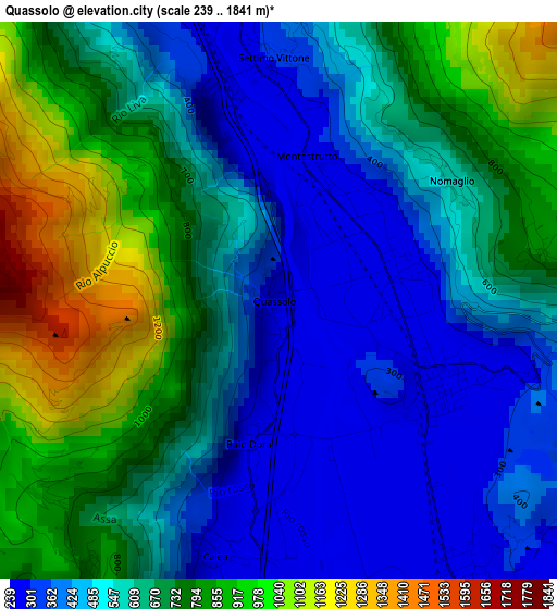
Below is the Elevation map of Quassolo, which displays elevation range with different colors. Scale of the first map is from 239 to 1841 m (784 to 6040 ft) with average elevation of 620.8 meters (=2037 ft) [note 1]
These maps also provides idea of topography and contour of this city, they are displayed at different zoom levels. More info about maps, scale and edge coordinates you can find below images.
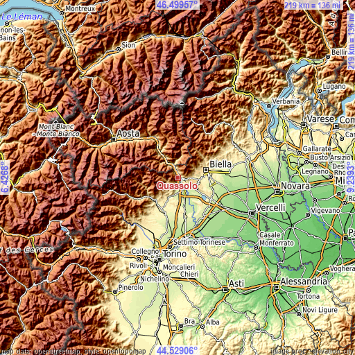
| \ | Map #1 | Topo.Map |
| Scale [m] | 239..1841 m | × |
| Scale [ft] | 784..6040 ft | × |
| Average | 620.8 m = 2037 ft | × |
| Width | 6.85 km = 4.3 mi | 219.1 km = 136.1 mi |
| Height | 6.85 km = 4.3 mi | 219.1 km = 136.1 mi |
| ↑Max Latitude | 45.553721° | 46.49957° |
| Latitude at center | 45.52294° | 45.52294° |
| ↓Min Latitude | 45.492142° | 44.52906° |
| ← Min Longitude | 7.789105° | 6.4268° |
| Longitude center | 7.83305° | 7.83305° |
| →Max Longitude | 7.876995° | 9.2393° |
Nearby cities:
Cities around Quassolo sort by population:
• Montalto Dora elevation 250 m
4.3 km,  147°
147°
• Borgofranco d'Ivrea 256 m
2.1 km,  110°
110°
• Lessolo 285 m
5.2 km,  195°
195°
• Quincinetto 287 m
4.7 km,  335°
335°
• Settimo Vittone 315 m
2.9 km,  0°
0°
• Tavagnasco 271 m
2.5 km, 341°
• Vico Canavese 724 m
5.3 km,  232°
232°
• Brosso 766 m
4.2 km,  214°
214°
• Andrate 788 m
3.8 km,  84°
84°
• Donato 690 m
6 km,  86°
86°
• Nomaglio 575 m
2.6 km,  55°
55°
• Meugliano 675 m
5.5 km, 228°
Multilingual:
 En español:
Quassolo elevación 261 m.
 En France:
Quassolo élévation 261 m.
 Auf Deutsch:
Quassolo höhe über dem Meeresspiegel ist 261 m.

Sources and notes:
- [note 1] Map square and city borders are not equal. Map elevation data is calculated only from area inside that square.
- [src 1] Elevation data from geonames database provided with same terms of usage.
- [src 2] The elevation map of Quassolo is generated using elevation data from NASA's 3 arcsec (90m) resolution SRTM data.
- [src 3] Base (background) map © OpenStreetMap contributors tiles are generated by Geofabrik and OpenTopoMap.
Copyright & License:
This Quassolo Elevation Map is licensed under CC BY-SA. You may reuse any part from this page, if you give a proper credit by linking to this URL:
 More info on terms of use page.