Burolo elevation
Burolo (Piedmont, Torino), Italy elevation is 277 meters and Burolo elevation in feet is 909 ft above sea level [src 1]. Burolo is a seat of a third-order administrative division (feature code) with elevation that is 45 meters (148 ft) smaller than average city elevation in Italy.
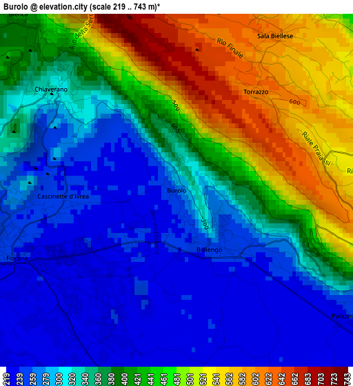
Below is the Elevation map of Burolo, which displays elevation range with different colors. Scale of the first map is from 219 to 743 m (719 to 2438 ft) with average elevation of 370.4 meters (=1215 ft) [note 1]
These maps also provides idea of topography and contour of this city, they are displayed at different zoom levels. More info about maps, scale and edge coordinates you can find below images.
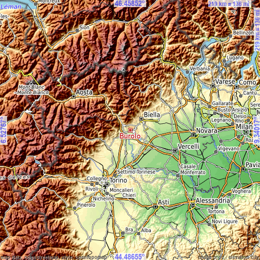
| \ | Map #1 | Topo.Map |
| Scale [m] | 219..743 m | × |
| Scale [ft] | 719..2438 ft | × |
| Average | 370.4 m = 1215 ft | × |
| Width | 6.85 km = 4.3 mi | 219.3 km = 136.3 mi |
| Height | 6.85 km = 4.3 mi | 219.3 km = 136.3 mi |
| ↑Max Latitude | 45.511964° | 46.45852° |
| Latitude at center | 45.48116° | 45.48116° |
| ↓Min Latitude | 45.45034° | 44.48655° |
| ← Min Longitude | 7.889975° | 6.52767° |
| Longitude center | 7.93392° | 7.93392° |
| →Max Longitude | 7.977865° | 9.34017° |
Nearby cities:
Cities around Burolo sort by population:
• Ivrea elevation 265 m
4.8 km,  251°
251°
• Montalto Dora 250 m
5.6 km,  279°
279°
• Albiano d'Ivrea 234 m
5.3 km,  168°
168°
• Cascinette d'Ivrea 244 m
2.2 km,  267°
267°
• Chiaverano 316 m
3.1 km,  308°
308°
• Bollengo 252 m
1.2 km,  151°
151°
• Palazzo Canavese 246 m
4.2 km,  125°
125°
• Sala Biellese 611 m
3.6 km,  31°
31°
• Donato 690 m
5.4 km,  339°
339°
• Zubiena 497 m
5 km,  75°
75°
• Torrazzo 620 m
2.5 km,  39°
39°
• Magnano 538 m
5.7 km,  110°
110°
Multilingual:
 En español:
Burolo elevación 277 m.
 En France:
Burolo élévation 277 m.


Sources and notes:
- [note 1] Map square and city borders are not equal. Map elevation data is calculated only from area inside that square.
- [src 1] Elevation data from geonames database provided with same terms of usage.
- [src 2] The elevation map of Burolo is generated using elevation data from NASA's 3 arcsec (90m) resolution SRTM data.
- [src 3] Base (background) map © OpenStreetMap contributors tiles are generated by Geofabrik and OpenTopoMap.
Copyright & License:
This Burolo Elevation Map is licensed under CC BY-SA. You may reuse any part from this page, if you give a proper credit by linking to this URL:
 More info on terms of use page.