Graglia elevation
Graglia (Piedmont, Provincia di Biella), Italy elevation is 596 meters and Graglia elevation in feet is 1955 ft above sea level [src 1]. Graglia is a seat of a third-order administrative division (feature code) with elevation that is 274 meters (899 ft) bigger than average city elevation in Italy.
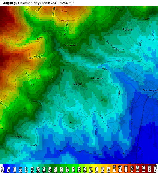
Below is the Elevation map of Graglia, which displays elevation range with different colors. Scale of the first map is from 334 to 1264 m (1096 to 4147 ft) with average elevation of 603.8 meters (=1981 ft) [note 1]
These maps also provides idea of topography and contour of this city, they are displayed at different zoom levels. More info about maps, scale and edge coordinates you can find below images.
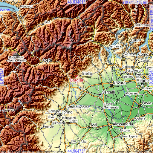
| \ | Map #1 | Topo.Map |
| Scale [m] | 334..1264 m | × |
| Scale [ft] | 1096..4147 ft | × |
| Average | 603.8 m = 1981 ft | × |
| Width | 6.84 km = 4.3 mi | 219 km = 136.1 mi |
| Height | 6.84 km = 4.3 mi | 219 km = 136.1 mi |
| ↑Max Latitude | 45.588762° | 46.53401° |
| Latitude at center | 45.558° | 45.558° |
| ↓Min Latitude | 45.527222° | 44.56473° |
| ← Min Longitude | 7.935045° | 6.57274° |
| Longitude center | 7.97899° | 7.97899° |
| →Max Longitude | 8.022935° | 9.38524° |
Nearby cities:
Cities around Graglia sort by population:
• Biella elevation 420 m
6.2 km,  84°
84°
• Mongrando 342 m
4 km,  146°
146°
• Occhieppo Inferiore 384 m
3.4 km,  105°
105°
• Ceresane-Curanuova 329 m
4.3 km, 149°
• Occhieppo Superiore 468 m
2.2 km,  72°
72°
• Pralungo 544 m
5.9 km,  53°
53°
• Pollone 567 m
3.2 km,  40°
40°
• Sordevolo 658 m
1.8 km,  345°
345°
• Netro 566 m
3.2 km,  231°
231°
• Camburzano 429 m
2.4 km,  130°
130°
• Muzzano 561 m
0.8 km, 68°
• Sala Biellese 611 m
5.7 km,  196°
196°
Multilingual:
 En español:
Graglia elevación 596 m.
 En France:
Graglia élévation 596 m.


Sources and notes:
- [note 1] Map square and city borders are not equal. Map elevation data is calculated only from area inside that square.
- [src 1] Elevation data from geonames database provided with same terms of usage.
- [src 2] The elevation map of Graglia is generated using elevation data from NASA's 3 arcsec (90m) resolution SRTM data.
- [src 3] Base (background) map © OpenStreetMap contributors tiles are generated by Geofabrik and OpenTopoMap.
Copyright & License:
This Graglia Elevation Map is licensed under CC BY-SA. You may reuse any part from this page, if you give a proper credit by linking to this URL:
 More info on terms of use page.