Pralungo elevation
Pralungo (Piedmont, Provincia di Biella), Italy elevation is 544 meters and Pralungo elevation in feet is 1785 ft above sea level [src 1]. Pralungo is a seat of a third-order administrative division (feature code) with elevation that is 222 meters (728 ft) bigger than average city elevation in Italy.
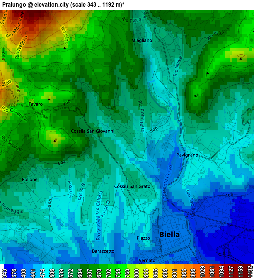
Below is the Elevation map of Pralungo, which displays elevation range with different colors. Scale of the first map is from 343 to 1192 m (1125 to 3911 ft) with average elevation of 572.2 meters (=1877 ft) [note 1]
These maps also provides idea of topography and contour of this city, they are displayed at different zoom levels. More info about maps, scale and edge coordinates you can find below images.
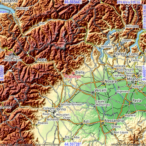
| \ | Map #1 | Topo.Map |
| Scale [m] | 343..1192 m | × |
| Scale [ft] | 1125..3911 ft | × |
| Average | 572.2 m = 1877 ft | × |
| Width | 6.84 km = 4.3 mi | 218.8 km = 136 mi |
| Height | 6.84 km = 4.3 mi | 218.8 km = 136 mi |
| ↑Max Latitude | 45.620734° | 46.56544° |
| Latitude at center | 45.58999° | 45.58999° |
| ↓Min Latitude | 45.559229° | 44.59728° |
| ← Min Longitude | 7.995815° | 6.63351° |
| Longitude center | 8.03976° | 8.03976° |
| →Max Longitude | 8.083705° | 9.44601° |
Nearby cities:
Cities around Pralungo sort by population:
• Biella elevation 420 m
3.3 km,  154°
154°
• Occhieppo Inferiore 384 m
4.7 km,  198°
198°
• Andorno Cacciorna 549 m
2.6 km,  28°
28°
• Tollegno 485 m
0.9 km,  84°
84°
• Occhieppo Superiore 468 m
3.9 km,  222°
222°
• Pollone 567 m
2.9 km,  246°
246°
• Sagliano Micca 586 m
4 km,  3°
3°
• Ronco Biellese 462 m
4.2 km,  107°
107°
• Tavigliano 648 m
3.7 km,  14°
14°
• Zumaglia 587 m
3.9 km, 83°
• Miagliano 540 m
2.6 km, 8°
• Selve Marcone 759 m
5 km,  48°
48°
Multilingual:
 En español:
Pralungo elevación 544 m.
 En France:
Pralungo élévation 544 m.
 Auf Deutsch:
Pralungo höhe über dem Meeresspiegel ist 544 m.

Sources and notes:
- [note 1] Map square and city borders are not equal. Map elevation data is calculated only from area inside that square.
- [src 1] Elevation data from geonames database provided with same terms of usage.
- [src 2] The elevation map of Pralungo is generated using elevation data from NASA's 3 arcsec (90m) resolution SRTM data.
- [src 3] Base (background) map © OpenStreetMap contributors tiles are generated by Geofabrik and OpenTopoMap.
Copyright & License:
This Pralungo Elevation Map is licensed under CC BY-SA. You may reuse any part from this page, if you give a proper credit by linking to this URL:
 More info on terms of use page.