Corniglio elevation
Corniglio (Emilia-Romagna, Provincia di Parma), Italy elevation is 669 meters and Corniglio elevation in feet is 2195 ft above sea level [src 1]. Corniglio is a seat of a third-order administrative division (feature code) with elevation that is 347 meters (1138 ft) bigger than average city elevation in Italy.
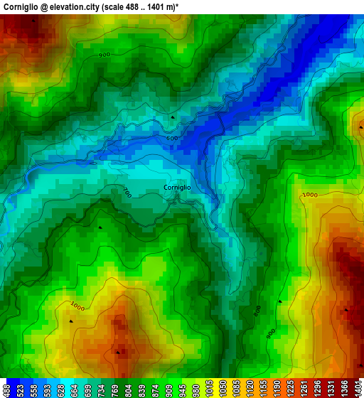
Below is the Elevation map of Corniglio, which displays elevation range with different colors. Scale of the first map is from 488 to 1401 m (1601 to 4596 ft) with average elevation of 848.5 meters (=2784 ft) [note 1]
These maps also provides idea of topography and contour of this city, they are displayed at different zoom levels. More info about maps, scale and edge coordinates you can find below images.
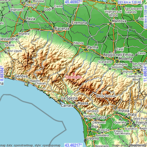
| \ | Map #1 | Topo.Map |
| Scale [m] | 488..1401 m | × |
| Scale [ft] | 1601..4596 ft | × |
| Average | 848.5 m = 2784 ft | × |
| Width | 6.97 km = 4.3 mi | 223.1 km = 138.6 mi |
| Height | 6.97 km = 4.3 mi | 223.1 km = 138.6 mi |
| ↑Max Latitude | 44.505599° | 45.46907° |
| Latitude at center | 44.47425° | 44.47425° |
| ↓Min Latitude | 44.442884° | 43.46217° |
| ← Min Longitude | 10.046145° | 8.68384° |
| Longitude center | 10.09009° | 10.09009° |
| →Max Longitude | 10.134035° | 11.49634° |
Nearby cities:
Cities around Corniglio sort by population:
• Pontremoli elevation 245 m
20.1 km,  236°
236°
• Berceto 809 m
8.8 km,  296°
296°
• Calestano 397 m
14.5 km,  10°
10°
• Solignano 256 m
17.9 km,  329°
329°
• Vetto 442 m
19.8 km,  86°
86°
• Bagnone 249 m
19.3 km,  203°
203°
• Tizzano Val Parma 796 m
9.9 km,  59°
59°
• Ramiseto 782 m
16.3 km,  114°
114°
• Palanzano 659 m
9.3 km,  117°
117°
• Monchio delle Corti 815 m
7.4 km,  159°
159°
• Terenzo 548 m
15.1 km,  359°
359°
• Stazione Valmozzola 273 m
16.5 km,  314°
314°
Multilingual:
 En español:
Corniglio elevación 669 m.
 En France:
Corniglio élévation 669 m.
 Auf Deutsch:
Corniglio höhe über dem Meeresspiegel ist 669 m.

Sources and notes:
- [note 1] Map square and city borders are not equal. Map elevation data is calculated only from area inside that square.
- [src 1] Elevation data from geonames database provided with same terms of usage.
- [src 2] The elevation map of Corniglio is generated using elevation data from NASA's 3 arcsec (90m) resolution SRTM data.
- [src 3] Base (background) map © OpenStreetMap contributors tiles are generated by Geofabrik and OpenTopoMap.
Copyright & License:
This Corniglio Elevation Map is licensed under CC BY-SA. You may reuse any part from this page, if you give a proper credit by linking to this URL:
 More info on terms of use page.