None elevation
None (Piedmont, Torino), Italy elevation is 248 meters and None elevation in feet is 814 ft above sea level [src 1]. None is a seat of a third-order administrative division (feature code) with elevation that is 74 meters (243 ft) smaller than average city elevation in Italy.
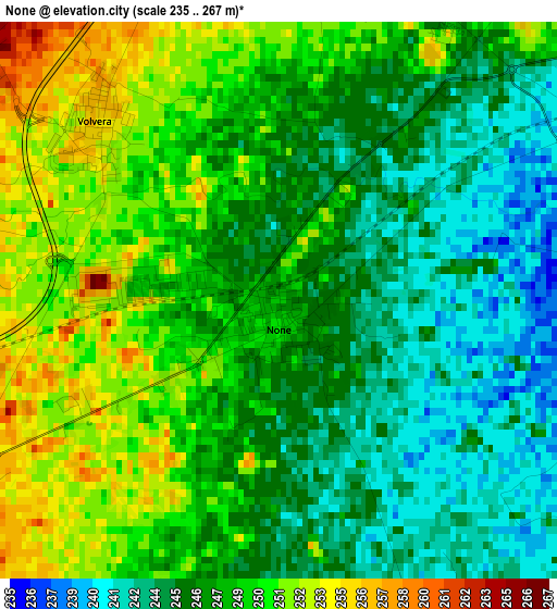
Below is the Elevation map of None, which displays elevation range with different colors. Scale of the first map is from 235 to 267 m (771 to 876 ft) with average elevation of 247.3 meters (=811 ft) [note 1]
These maps also provides idea of topography and contour of this city, they are displayed at different zoom levels. More info about maps, scale and edge coordinates you can find below images.
| \ | Map #1 | Map #2 | Topo.Map |
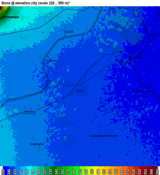
| Scale [m] | 235..267 m | 226..580 m | × |
| Scale [ft] | 771..876 ft | 741..1903 ft | × |
| Average | 247.3 m = 811 ft | 252.4 m = 828 ft | × |
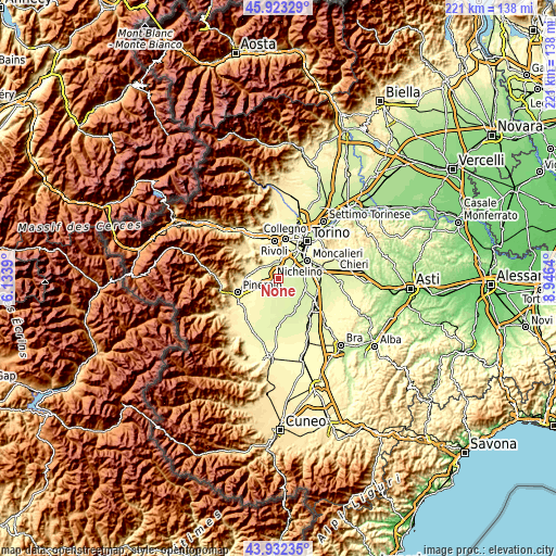
| Width | 6.92 km = 4.3 mi | 13.84 km = 8.6 mi | 221.4 km = 137.6 mi |
| Height | 6.92 km = 4.3 mi | 13.84 km = 8.6 mi | 221.4 km = 137.6 mi |
| ↑Max Latitude | 44.96755° | 44.998633° | 45.92329° |
| Latitude at center | 44.93645° | 44.93645° | 44.93645° |
| ↓Min Latitude | 44.905333° | 44.874199° | 43.93235° |
| ← Min Longitude | 7.496205° | 7.452259° | 6.1339° |
| Longitude center | 7.54015° | 7.54015° | 7.54015° |
| →Max Longitude | 7.584095° | 7.628041° | 8.9464° |
Nearby cities:
Cities around None sort by population:
• Orbassano elevation 272 m
7.7 km,  358°
358°
• Vinovo 234 m
7.4 km,  81°
81°
• Gerbole 284 m
7.7 km,  339°
339°
• Volvera 255 m
3 km,  312°
312°
• Candiolo 240 m
5.2 km,  61°
61°
• Garino 236 m
7.3 km, 56°
• Airasca 260 m
5 km,  244°
244°
• Piobesi Torinese 237 m
5.5 km,  94°
94°
• Gerbole-Zucche 270 m
5.8 km, 341°
• Pasta 266 m
8.4 km,  6°
6°
• Castagnole Piemonte 246 m
4.7 km,  154°
154°
• Scalenghe 260 m
6.3 km,  214°
214°
Multilingual:
 En español:
None elevación 248 m.
 En France:
None élévation 248 m.


Sources and notes:
- [note 1] Map square and city borders are not equal. Map elevation data is calculated only from area inside that square.
- [src 1] Elevation data from geonames database provided with same terms of usage.
- [src 2] The elevation map of None is generated using elevation data from NASA's 3 arcsec (90m) resolution SRTM data.
- [src 3] Base (background) map © OpenStreetMap contributors tiles are generated by Geofabrik and OpenTopoMap.
Copyright & License:
This None Elevation Map is licensed under CC BY-SA. You may reuse any part from this page, if you give a proper credit by linking to this URL:
 More info on terms of use page.