Gerbole elevation
Gerbole (Piedmont, Torino), Italy elevation is 284 meters and Gerbole elevation in feet is 932 ft above sea level [src 1]. Gerbole is a populated place (feature code) with elevation that is 38 meters (125 ft) smaller than average city elevation in Italy.
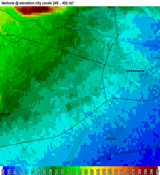
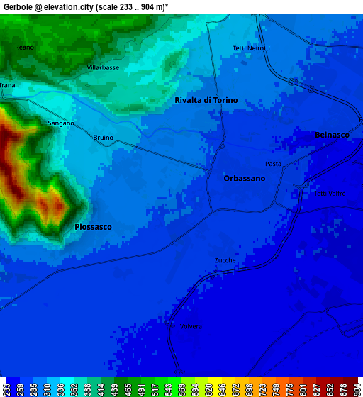
Below is the Elevation map of Gerbole, which displays elevation range with different colors. Scale of the first map is from 249 to 402 m (817 to 1319 ft) with average elevation of 284.4 meters (=933 ft) [note 1]
These maps also provides idea of topography and contour of this city, they are displayed at different zoom levels. More info about maps, scale and edge coordinates you can find below images.
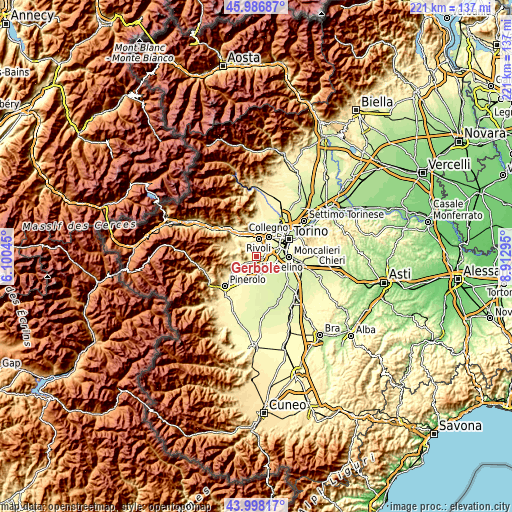
| \ | Map #1 | Map #2 | Topo.Map |
| Scale [m] | 249..402 m | 233..904 m | × |
| Scale [ft] | 817..1319 ft | 764..2966 ft | × |
| Average | 284.4 m = 933 ft | 311.6 m = 1022 ft | × |
| Width | 6.91 km = 4.3 mi | 13.82 km = 8.6 mi | 221.1 km = 137.4 mi |
| Height | 6.91 km = 4.3 mi | 13.82 km = 8.6 mi | 221.1 km = 137.4 mi |
| ↑Max Latitude | 45.032215° | 45.063263° | 45.98687° |
| Latitude at center | 45.00115° | 45.00115° | 45.00115° |
| ↓Min Latitude | 44.970068° | 44.938969° | 43.99817° |
| ← Min Longitude | 7.462755° | 7.418809° | 6.10045° |
| Longitude center | 7.5067° | 7.5067° | 7.5067° |
| →Max Longitude | 7.550645° | 7.594591° | 8.91295° |
Nearby cities:
Cities around Gerbole sort by population:
• Orbassano elevation 272 m
2.5 km,  78°
78°
• Piossasco 310 m
3.9 km,  248°
248°
• Rivalta di Torino 295 m
3.7 km,  17°
17°
• Bruino 306 m
2.8 km,  304°
304°
• Beinasco 263 m
6.7 km,  67°
67°
• Volvera 255 m
5.2 km,  175°
175°
• Sangano 340 m
5.2 km, 300°
• Gerbole-Zucche 270 m
1.9 km,  154°
154°
• Villarbasse 387 m
5.7 km,  328°
328°
• Pasta 266 m
3.8 km, 72°
• Borgo Melano 258 m
5.7 km, 73°
• Tetti Neirotti 312 m
6.4 km, 24°
Multilingual:
 En español:
Gerbole elevación 284 m.
 En France:
Gerbole élévation 284 m.


Sources and notes:
- [note 1] Map square and city borders are not equal. Map elevation data is calculated only from area inside that square.
- [src 1] Elevation data from geonames database provided with same terms of usage.
- [src 2] The elevation map of Gerbole is generated using elevation data from NASA's 3 arcsec (90m) resolution SRTM data.
- [src 3] Base (background) map © OpenStreetMap contributors tiles are generated by Geofabrik and OpenTopoMap.
Copyright & License:
This Gerbole Elevation Map is licensed under CC BY-SA. You may reuse any part from this page, if you give a proper credit by linking to this URL:
 More info on terms of use page.