Sālūmbar elevation
Sālūmbar (Rajasthan, Udaipur), India elevation is 242 meters and Sālūmbar elevation in feet is 794 ft above sea level [src 1]. Sālūmbar is a populated place (feature code) with elevation that is 51 meters (167 ft) smaller than average city elevation in India.
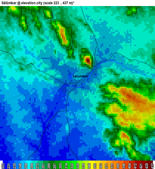
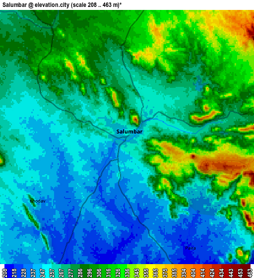
Below is the Elevation map of Sālūmbar, which displays elevation range with different colors. Scale of the first map is from 223 to 437 m (732 to 1434 ft) with average elevation of 267.5 meters (=878 ft) [note 1]
These maps also provides idea of topography and contour of this city, they are displayed at different zoom levels. More info about maps, scale and edge coordinates you can find below images.
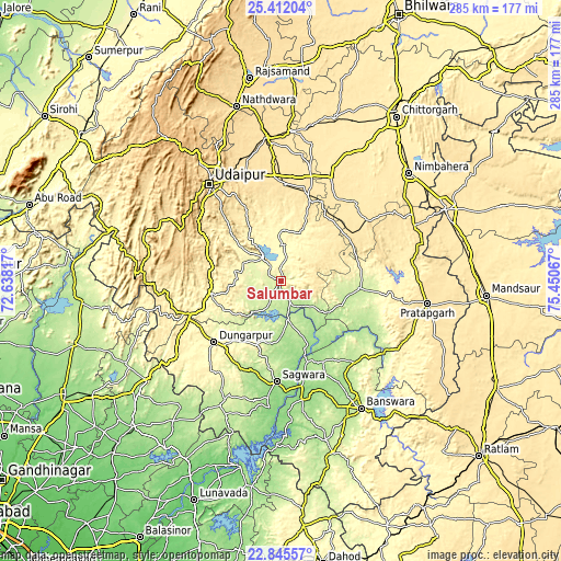
| \ | Map #1 | Map #2 | Topo.Map |
| Scale [m] | 223..437 m | 208..463 m | × |
| Scale [ft] | 732..1434 ft | 682..1519 ft | × |
| Average | 267.5 m = 878 ft | 276.9 m = 908 ft | × |
| Width | 8.92 km = 5.5 mi | 17.84 km = 11.1 mi | 285.4 km = 177.3 mi |
| Height | 8.92 km = 5.5 mi | 17.84 km = 11.1 mi | 285.4 km = 177.3 mi |
| ↑Max Latitude | 24.175337° | 24.215422° | 25.41204° |
| Latitude at center | 24.13524° | 24.13524° | 24.13524° |
| ↓Min Latitude | 24.09513° | 24.055007° | 22.84557° |
| ← Min Longitude | 74.000475° | 73.956529° | 72.63817° |
| Longitude center | 74.04442° | 74.04442° | 74.04442° |
| →Max Longitude | 74.088365° | 74.132311° | 75.45067° |
Nearby cities:
Cities around Sālūmbar sort by population:
• Udaipur elevation 565 m
60.3 km,  326°
326°
• Bānswāra 227 m
77.5 km,  148°
148°
• Nīmbāhera 447 m
84.1 km,  49°
49°
• Dūngarpur 292 m
46.7 km,  225°
225°
• Pratāpgarh 498 m
75.7 km,  98°
98°
• Chhoti Sādri 498 m
72 km,  67°
67°
• Bhindār 496 m
43.2 km,  19°
19°
• Bari Sādri 500 m
53.4 km, 54°
• Kānor 479 m
40.1 km,  33°
33°
• Jīran 485 m
88 km,  77°
77°
• Partāpur 155 m
61.7 km,  167°
167°
• Galiākot 136 m
68.5 km,  182°
182°
Multilingual:
 En español:
Sālūmbar elevación 242 m.
 En France:
Sālūmbar élévation 242 m.
 Auf Deutsch:
Sālūmbar höhe über dem Meeresspiegel ist 242 m.

Sources and notes:
- [note 1] Map square and city borders are not equal. Map elevation data is calculated only from area inside that square.
- [src 1] Elevation data from geonames database provided with same terms of usage.
- [src 2] The elevation map of Sālūmbar is generated using elevation data from NASA's 3 arcsec (90m) resolution SRTM data.
- [src 3] Base (background) map © OpenStreetMap contributors tiles are generated by Geofabrik and OpenTopoMap.
Copyright & License:
This Sālūmbar Elevation Map is licensed under CC BY-SA. You may reuse any part from this page, if you give a proper credit by linking to this URL:
 More info on terms of use page.