Bordon elevation
Bordon (England, Hampshire), United Kingdom elevation is 93 meters and Bordon elevation in feet is 305 ft above sea level [src 1]. Bordon is a populated place (feature code) with elevation that is 21 meters (69 ft) bigger than average city elevation in United Kingdom.
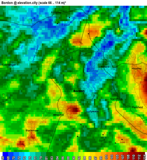
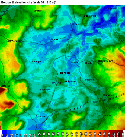
Below is the Elevation map of Bordon, which displays elevation range with different colors. Scale of the first map is from 66 to 114 m (217 to 374 ft) with average elevation of 84.6 meters (=278 ft) [note 1]
These maps also provides idea of topography and contour of this city, they are displayed at different zoom levels. More info about maps, scale and edge coordinates you can find below images.
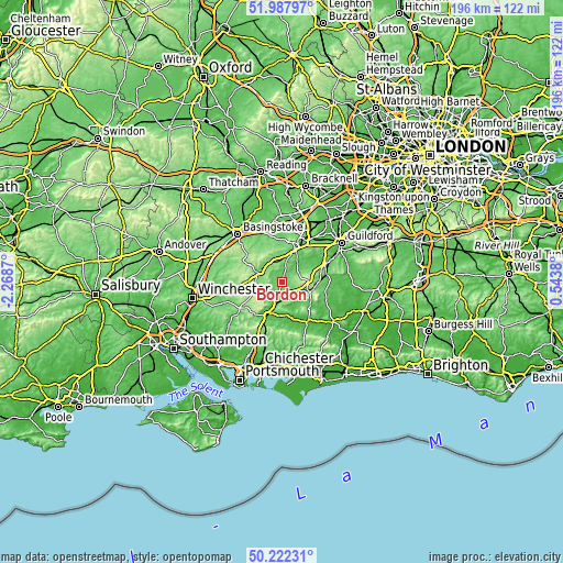
| \ | Map #1 | Map #2 | Topo.Map |
| Scale [m] | 66..114 m | 54..215 m | × |
| Scale [ft] | 217..374 ft | 177..705 ft | × |
| Average | 84.6 m = 278 ft | 104.4 m = 343 ft | × |
| Width | 6.13 km = 3.8 mi | 12.27 km = 7.6 mi | 196.3 km = 122 mi |
| Height | 6.13 km = 3.8 mi | 12.27 km = 7.6 mi | 196.3 km = 122 mi |
| ↑Max Latitude | 51.14115° | 51.168713° | 51.98797° |
| Latitude at center | 51.11357° | 51.11357° | 51.11357° |
| ↓Min Latitude | 51.085974° | 51.058361° | 50.22231° |
| ← Min Longitude | -0.906395° | -0.950341° | -2.2687° |
| Longitude center | -0.86245° | -0.86245° | -0.86245° |
| →Max Longitude | -0.818505° | -0.774559° | 0.5438° |
Nearby cities:
Cities around Bordon sort by population:
• Farnham elevation 71 m
12 km,  21°
21°
• Alton 104 m
8.8 km,  296°
296°
• Petersfield 62 m
13.1 km,  202°
202°
• Haslemere 157 m
11.1 km,  103°
103°
• Liphook 110 m
5.8 km,  134°
134°
• Liss 63 m
8.1 km,  194°
194°
• Hindhead 252 m
9 km,  89°
89°
• Four Marks 179 m
13.1 km,  266°
266°
• Long Sutton 125 m
13.1 km,  334°
334°
• Fernhurst 83 m
12.4 km, 125°
• Crondall 89 m
13.3 km,  359°
359°
• Churt 111 m
6.6 km,  67°
67°
Multilingual:
 En español:
Bordon elevación 93 m.
 En France:
Bordon élévation 93 m.


Sources and notes:
- [note 1] Map square and city borders are not equal. Map elevation data is calculated only from area inside that square.
- [src 1] Elevation data from geonames database provided with same terms of usage.
- [src 2] The elevation map of Bordon is generated using elevation data from NASA's 3 arcsec (90m) resolution SRTM data.
- [src 3] Base (background) map © OpenStreetMap contributors tiles are generated by Geofabrik and OpenTopoMap.
Copyright & License:
This Bordon Elevation Map is licensed under CC BY-SA. You may reuse any part from this page, if you give a proper credit by linking to this URL:
 More info on terms of use page.