Long Sutton elevation
Long Sutton (England, Hampshire), United Kingdom elevation is 125 meters and Long Sutton elevation in feet is 410 ft above sea level [src 1]. Long Sutton is a populated place (feature code) with elevation that is 53 meters (174 ft) bigger than average city elevation in United Kingdom.
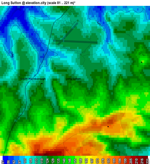
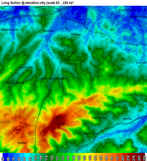
Below is the Elevation map of Long Sutton, which displays elevation range with different colors. Scale of the first map is from 81 to 221 m (266 to 725 ft) with average elevation of 130.3 meters (=427 ft) [note 1]
These maps also provides idea of topography and contour of this city, they are displayed at different zoom levels. More info about maps, scale and edge coordinates you can find below images.
| \ | Map #1 | Map #2 | Topo.Map |
| Scale [m] | 81..221 m | 63..229 m | × |
| Scale [ft] | 266..725 ft | 207..751 ft | × |
| Average | 130.3 m = 427 ft | 120.9 m = 397 ft | × |
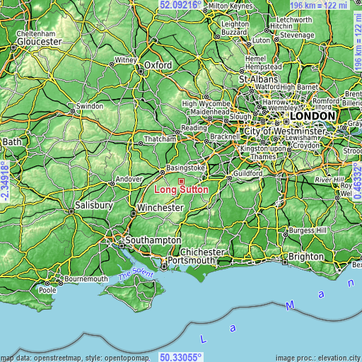
| Width | 6.12 km = 3.8 mi | 12.24 km = 7.6 mi | 195.9 km = 121.7 mi |
| Height | 6.12 km = 3.8 mi | 12.24 km = 7.6 mi | 195.9 km = 121.7 mi |
| ↑Max Latitude | 51.247296° | 51.274796° | 52.09216° |
| Latitude at center | 51.21978° | 51.21978° | 51.21978° |
| ↓Min Latitude | 51.192247° | 51.164698° | 50.33055° |
| ← Min Longitude | -0.986875° | -1.030821° | -2.34918° |
| Longitude center | -0.94293° | -0.94293° | -0.94293° |
| →Max Longitude | -0.898985° | -0.855039° | 0.46332° |
Nearby cities:
Cities around Long Sutton sort by population:
• Basingstoke elevation 96 m
11.1 km,  295°
295°
• Aldershot 99 m
12.9 km,  75°
75°
• Fleet 74 m
10.4 km,  47°
47°
• Farnham 71 m
9.9 km,  93°
93°
• Bordon 93 m
13.1 km,  154°
154°
• Alton 104 m
8.1 km,  195°
195°
• Hale 108 m
10.8 km, 84°
• Hook 82 m
7.3 km,  350°
350°
• Hartley Wintney 70 m
9.8 km,  17°
17°
• Old Basing 79 m
8.2 km,  309°
309°
• Odiham 96 m
3.8 km,  3°
3°
• Crondall 89 m
5.7 km, 75°
Multilingual:
 En español:
Long Sutton elevación 125 m.
 En France:
Long Sutton élévation 125 m.
 Auf Deutsch:
Long Sutton höhe über dem Meeresspiegel ist 125 m.

Sources and notes:
- [note 1] Map square and city borders are not equal. Map elevation data is calculated only from area inside that square.
- [src 1] Elevation data from geonames database provided with same terms of usage.
- [src 2] The elevation map of Long Sutton is generated using elevation data from NASA's 3 arcsec (90m) resolution SRTM data.
- [src 3] Base (background) map © OpenStreetMap contributors tiles are generated by Geofabrik and OpenTopoMap.
Copyright & License:
This Long Sutton Elevation Map is licensed under CC BY-SA. You may reuse any part from this page, if you give a proper credit by linking to this URL:
 More info on terms of use page.