Hindhead elevation
Hindhead (England, Surrey), United Kingdom elevation is 252 meters and Hindhead elevation in feet is 827 ft above sea level [src 1]. Hindhead is a populated place (feature code) with elevation that is 180 meters (591 ft) bigger than average city elevation in United Kingdom.
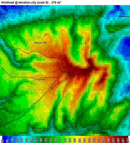
Below is the Elevation map of Hindhead, which displays elevation range with different colors. Scale of the first map is from 92 to 274 m (302 to 899 ft) with average elevation of 172.5 meters (=566 ft) [note 1]
These maps also provides idea of topography and contour of this city, they are displayed at different zoom levels. More info about maps, scale and edge coordinates you can find below images.
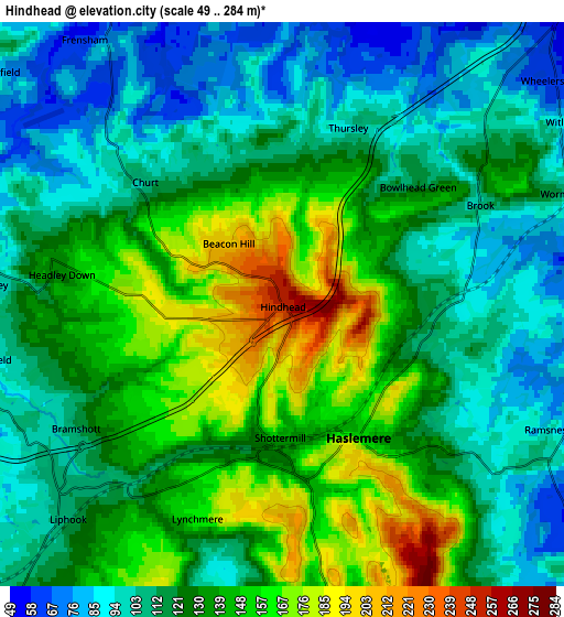
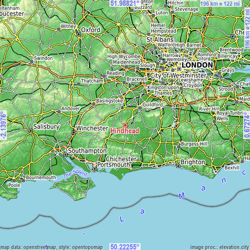
| \ | Map #1 | Map #2 | Topo.Map |
| Scale [m] | 92..274 m | 49..284 m | × |
| Scale [ft] | 302..899 ft | 161..932 ft | × |
| Average | 172.5 m = 566 ft | 126.2 m = 414 ft | × |
| Width | 6.13 km = 3.8 mi | 12.27 km = 7.6 mi | 196.3 km = 122 mi |
| Height | 6.13 km = 3.8 mi | 12.27 km = 7.6 mi | 196.3 km = 122 mi |
| ↑Max Latitude | 51.14139° | 51.168953° | 51.98821° |
| Latitude at center | 51.11381° | 51.11381° | 51.11381° |
| ↓Min Latitude | 51.086214° | 51.058601° | 50.22255° |
| ← Min Longitude | -0.777455° | -0.821401° | -2.13976° |
| Longitude center | -0.73351° | -0.73351° | -0.73351° |
| →Max Longitude | -0.689565° | -0.645619° | 0.67274° |
Nearby cities:
Cities around Hindhead sort by population:
• Farnham elevation 71 m
12.1 km,  337°
337°
• Godalming 46 m
11.5 km,  45°
45°
• Bordon 93 m
9 km,  269°
269°
• Haslemere 157 m
3.2 km,  145°
145°
• Liphook 110 m
6.4 km,  229°
229°
• Witley 88 m
7.2 km,  56°
56°
• Milford 57 m
8.7 km,  41°
41°
• Elstead 51 m
8.2 km,  13°
13°
• Chiddingfold 51 m
7.8 km,  86°
86°
• Fernhurst 83 m
7.3 km,  171°
171°
• Wormley 111 m
6.5 km,  67°
67°
• Churt 111 m
3.8 km,  310°
310°
Multilingual:
 En español:
Hindhead elevación 252 m.
 En France:
Hindhead élévation 252 m.
 Auf Deutsch:
Hindhead höhe über dem Meeresspiegel ist 252 m.

Sources and notes:
- [note 1] Map square and city borders are not equal. Map elevation data is calculated only from area inside that square.
- [src 1] Elevation data from geonames database provided with same terms of usage.
- [src 2] The elevation map of Hindhead is generated using elevation data from NASA's 3 arcsec (90m) resolution SRTM data.
- [src 3] Base (background) map © OpenStreetMap contributors tiles are generated by Geofabrik and OpenTopoMap.
Copyright & License:
This Hindhead Elevation Map is licensed under CC BY-SA. You may reuse any part from this page, if you give a proper credit by linking to this URL:
 More info on terms of use page.