Four Marks elevation
Four Marks (England, Hampshire), United Kingdom elevation is 179 meters and Four Marks elevation in feet is 587 ft above sea level [src 1]. Four Marks is a populated place (feature code) with elevation that is 107 meters (351 ft) bigger than average city elevation in United Kingdom.
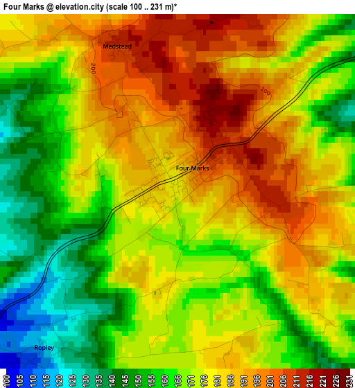
Below is the Elevation map of Four Marks, which displays elevation range with different colors. Scale of the first map is from 100 to 231 m (328 to 758 ft) with average elevation of 174.6 meters (=573 ft) [note 1]
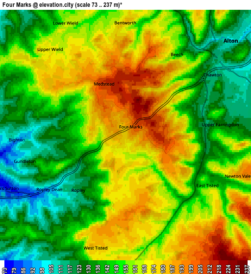
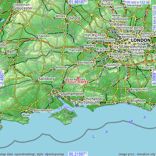
These maps also provides idea of topography and contour of this city, they are displayed at different zoom levels. More info about maps, scale and edge coordinates you can find below images.
| \ | Map #1 | Map #2 | Topo.Map |
| Scale [m] | 100..231 m | 73..237 m | × |
| Scale [ft] | 328..758 ft | 240..778 ft | × |
| Average | 174.6 m = 573 ft | 154.5 m = 507 ft | × |
| Width | 6.14 km = 3.8 mi | 12.27 km = 7.6 mi | 196.3 km = 122 mi |
| Height | 6.14 km = 3.8 mi | 12.27 km = 7.6 mi | 196.3 km = 122 mi |
| ↑Max Latitude | 51.134933° | 51.1625° | 51.98187° |
| Latitude at center | 51.10735° | 51.10735° | 51.10735° |
| ↓Min Latitude | 51.07975° | 51.052134° | 50.21597° |
| ← Min Longitude | -1.093395° | -1.137341° | -2.4557° |
| Longitude center | -1.04945° | -1.04945° | -1.04945° |
| →Max Longitude | -1.005505° | -0.961559° | 0.3568° |
Nearby cities:
Cities around Four Marks sort by population:
• Basingstoke elevation 96 m
17.4 km,  351°
351°
• Bordon 93 m
13.1 km,  86°
86°
• Alton 104 m
7 km,  48°
48°
• Petersfield 62 m
14 km,  144°
144°
• Liphook 110 m
17.5 km,  101°
101°
• Liss 63 m
13.1 km,  123°
123°
• New Alresford 85 m
8.7 km,  254°
254°
• Long Sutton 125 m
14.5 km,  30°
30°
• Kings Worthy 47 m
17.5 km,  263°
263°
• Old Basing 79 m
17.8 km,  3°
3°
• Odiham 96 m
18 km, 25°
• Crondall 89 m
19.1 km,  42°
42°
Multilingual:
 En español:
Four Marks elevación 179 m.
 En France:
Four Marks élévation 179 m.
 Auf Deutsch:
Four Marks höhe über dem Meeresspiegel ist 179 m.

Sources and notes:
- [note 1] Map square and city borders are not equal. Map elevation data is calculated only from area inside that square.
- [src 1] Elevation data from geonames database provided with same terms of usage.
- [src 2] The elevation map of Four Marks is generated using elevation data from NASA's 3 arcsec (90m) resolution SRTM data.
- [src 3] Base (background) map © OpenStreetMap contributors tiles are generated by Geofabrik and OpenTopoMap.
Copyright & License:
This Four Marks Elevation Map is licensed under CC BY-SA. You may reuse any part from this page, if you give a proper credit by linking to this URL:
 More info on terms of use page.