Eattington elevation
Eattington (England, Warwickshire), United Kingdom elevation is 115 meters and Eattington elevation in feet is 377 ft above sea level [src 1]. Eattington is a populated place (feature code) with elevation that is 43 meters (141 ft) bigger than average city elevation in United Kingdom.
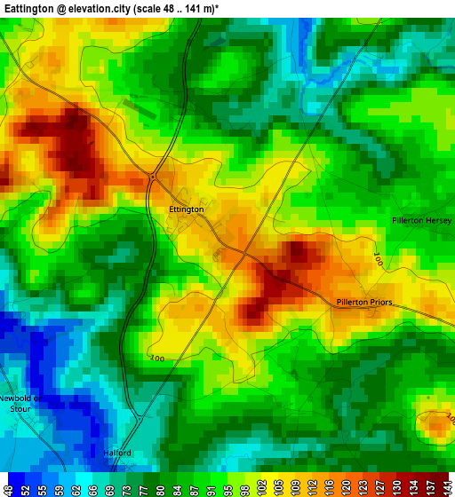
Below is the Elevation map of Eattington, which displays elevation range with different colors. Scale of the first map is from 48 to 141 m (157 to 463 ft) with average elevation of 89.4 meters (=293 ft) [note 1]
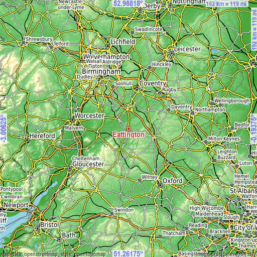
These maps also provides idea of topography and contour of this city, they are displayed at different zoom levels. More info about maps, scale and edge coordinates you can find below images.
| \ | Map #1 | Topo.Map |
| Scale [m] | 48..141 m | × |
| Scale [ft] | 157..463 ft | × |
| Average | 89.4 m = 293 ft | × |
| Width | 6 km = 3.7 mi | 192 km = 119.3 mi |
| Height | 6 km = 3.7 mi | 191.9 km = 119.2 mi |
| ↑Max Latitude | 52.160297° | 52.98818° |
| Latitude at center | 52.13333° | 52.13333° |
| ↓Min Latitude | 52.106347° | 51.26175° |
| ← Min Longitude | -1.643945° | -3.00625° |
| Longitude center | -1.6° | -1.6° |
| →Max Longitude | -1.556055° | -0.19375° |
Nearby cities:
Cities around Eattington sort by population:
• Stratford-upon-Avon elevation 44 m
9.8 km,  311°
311°
• Wellesbourne Mountford 49 m
6.6 km,  354°
354°
• Wellesbourne 50 m
7.1 km,  5°
5°
• Shipston on Stour 72 m
8.3 km,  193°
193°
• Chipping Campden 139 m
15.2 km,  232°
232°
• Farnborough 155 m
15.8 km,  86°
86°
• Harbury 126 m
15 km,  40°
40°
• Kineton 91 m
6.6 km,  66°
66°
• Mickleton 75 m
12.3 km,  247°
247°
• Honeybourne 47 m
16.4 km, 254°
• Wilmcote 76 m
14.9 km, 310°
• Lower Brailes 109 m
10 km,  156°
156°
Multilingual:
 En español:
Eattington elevación 115 m.
 En France:
Eattington élévation 115 m.
 Auf Deutsch:
Eattington höhe über dem Meeresspiegel ist 115 m.

Sources and notes:
- [note 1] Map square and city borders are not equal. Map elevation data is calculated only from area inside that square.
- [src 1] Elevation data from geonames database provided with same terms of usage.
- [src 2] The elevation map of Eattington is generated using elevation data from NASA's 3 arcsec (90m) resolution SRTM data.
- [src 3] Base (background) map © OpenStreetMap contributors tiles are generated by Geofabrik and OpenTopoMap.
Copyright & License:
This Eattington Elevation Map is licensed under CC BY-SA. You may reuse any part from this page, if you give a proper credit by linking to this URL:
 More info on terms of use page.