Harbury elevation
Harbury (England, Warwickshire), United Kingdom elevation is 126 meters and Harbury elevation in feet is 413 ft above sea level [src 1]. Harbury is a populated place (feature code) with elevation that is 54 meters (177 ft) bigger than average city elevation in United Kingdom.
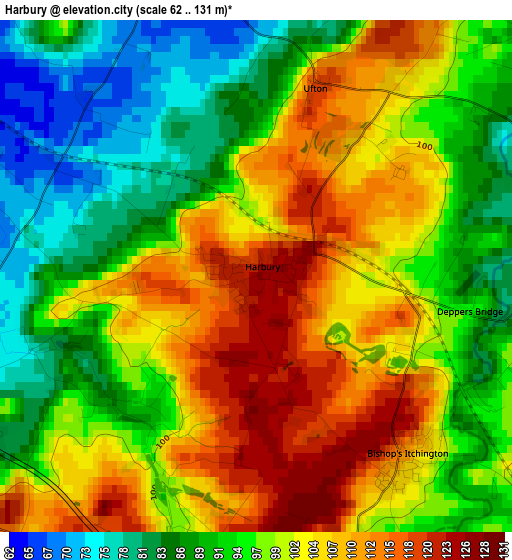
Below is the Elevation map of Harbury, which displays elevation range with different colors. Scale of the first map is from 62 to 131 m (203 to 430 ft) with average elevation of 98.5 meters (=323 ft) [note 1]
These maps also provides idea of topography and contour of this city, they are displayed at different zoom levels. More info about maps, scale and edge coordinates you can find below images.
| \ | Map #1 | Topo.Map |
| Scale [m] | 62..131 m | × |
| Scale [ft] | 203..430 ft | × |
| Average | 98.5 m = 323 ft | × |
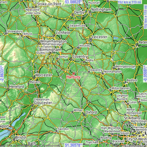
| Width | 5.98 km = 3.7 mi | 191.5 km = 119 mi |
| Height | 5.98 km = 3.7 mi | 191.5 km = 119 mi |
| ↑Max Latitude | 52.262275° | 53.08825° |
| Latitude at center | 52.23537° | 52.23537° |
| ↓Min Latitude | 52.208449° | 51.36578° |
| ← Min Longitude | -1.501005° | -2.86331° |
| Longitude center | -1.45706° | -1.45706° |
| →Max Longitude | -1.413115° | -0.05081° |
Nearby cities:
Cities around Harbury sort by population:
• Royal Leamington Spa elevation 74 m
7 km,  322°
322°
• Warwick 57 m
10.1 km,  301°
301°
• Southam 87 m
5.1 km,  67°
67°
• Wellesbourne Mountford 49 m
11.4 km,  245°
245°
• Wellesbourne 50 m
10 km,  244°
244°
• Claydon 137 m
12.9 km,  138°
138°
• Farnborough 155 m
11.9 km,  149°
149°
• Hatton 100 m
13.9 km, 301°
• Kineton 91 m
9.5 km,  202°
202°
• Long Itchington 75 m
7 km,  39°
39°
• Stockton 102 m
7.7 km,  58°
58°
• Leek Wootton 90 m
12.4 km, 317°
Multilingual:
 En español:
Harbury elevación 126 m.
 En France:
Harbury élévation 126 m.


Sources and notes:
- [note 1] Map square and city borders are not equal. Map elevation data is calculated only from area inside that square.
- [src 1] Elevation data from geonames database provided with same terms of usage.
- [src 2] The elevation map of Harbury is generated using elevation data from NASA's 3 arcsec (90m) resolution SRTM data.
- [src 3] Base (background) map © OpenStreetMap contributors tiles are generated by Geofabrik and OpenTopoMap.
Copyright & License:
This Harbury Elevation Map is licensed under CC BY-SA. You may reuse any part from this page, if you give a proper credit by linking to this URL:
 More info on terms of use page.