Wellesbourne Mountford elevation
Wellesbourne Mountford (England, Warwickshire), United Kingdom elevation is 49 meters and Wellesbourne Mountford elevation in feet is 161 ft above sea level [src 1]. Wellesbourne Mountford is a populated place (feature code) with elevation that is 23 meters (75 ft) smaller than average city elevation in United Kingdom.
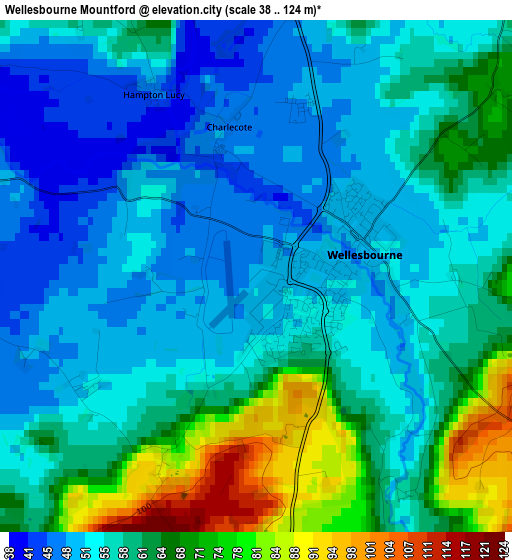
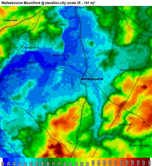
Below is the Elevation map of Wellesbourne Mountford, which displays elevation range with different colors. Scale of the first map is from 38 to 124 m (125 to 407 ft) with average elevation of 58.2 meters (=191 ft) [note 1]
These maps also provides idea of topography and contour of this city, they are displayed at different zoom levels. More info about maps, scale and edge coordinates you can find below images.
| \ | Map #1 | Map #2 | Topo.Map |
| Scale [m] | 38..124 m | 35..141 m | × |
| Scale [ft] | 125..407 ft | 115..463 ft | × |
| Average | 58.2 m = 191 ft | 70.2 m = 230 ft | × |
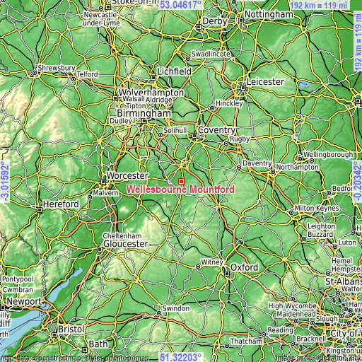
| Width | 5.99 km = 3.7 mi | 11.98 km = 7.4 mi | 191.7 km = 119.1 mi |
| Height | 5.99 km = 3.7 mi | 11.98 km = 7.4 mi | 191.7 km = 119.1 mi |
| ↑Max Latitude | 52.219391° | 52.246305° | 53.04617° |
| Latitude at center | 52.19246° | 52.19246° | 52.19246° |
| ↓Min Latitude | 52.165513° | 52.138549° | 51.32203° |
| ← Min Longitude | -1.653615° | -1.697561° | -3.01592° |
| Longitude center | -1.60967° | -1.60967° | -1.60967° |
| →Max Longitude | -1.565725° | -1.521779° | -0.20342° |
Nearby cities:
Cities around Wellesbourne Mountford sort by population:
• Royal Leamington Spa elevation 74 m
12 km,  30°
30°
• Stratford-upon-Avon 44 m
6.7 km,  269°
269°
• Warwick 57 m
10.3 km,  10°
10°
• Wellesbourne 50 m
1.4 km,  68°
68°
• Shipston on Stour 72 m
14.7 km,  184°
184°
• Harbury 126 m
11.4 km, 65°
• Hatton 100 m
12.1 km,  352°
352°
• Kineton 91 m
7.8 km,  120°
120°
• Mickleton 75 m
15.5 km,  223°
223°
• Wilmcote 76 m
11.1 km,  286°
286°
• Eattington 115 m
6.6 km,  174°
174°
• Leek Wootton 90 m
14.1 km, 8°
Multilingual:
 En español:
Wellesbourne Mountford elevación 49 m.
 En France:
Wellesbourne Mountford élévation 49 m.
 Auf Deutsch:
Wellesbourne Mountford höhe über dem Meeresspiegel ist 49 m.
 На русском:
Wellesbourne Mountford высота над уровнем моря 49 м
Sources and notes:
- [note 1] Map square and city borders are not equal. Map elevation data is calculated only from area inside that square.
- [src 1] Elevation data from geonames database provided with same terms of usage.
- [src 2] The elevation map of Wellesbourne Mountford is generated using elevation data from NASA's 3 arcsec (90m) resolution SRTM data.
- [src 3] Base (background) map © OpenStreetMap contributors tiles are generated by Geofabrik and OpenTopoMap.
Copyright & License:
This Wellesbourne Mountford Elevation Map is licensed under CC BY-SA. You may reuse any part from this page, if you give a proper credit by linking to this URL:
 More info on terms of use page.