Mickleton elevation
Mickleton (England, Gloucestershire), United Kingdom elevation is 75 meters and Mickleton elevation in feet is 246 ft above sea level [src 1]. Mickleton is a populated place (feature code) with elevation that is 3 meters (10 ft) bigger than average city elevation in United Kingdom.
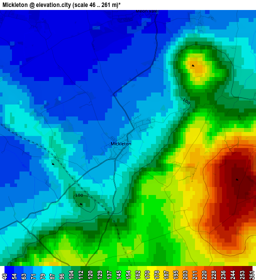
Below is the Elevation map of Mickleton, which displays elevation range with different colors. Scale of the first map is from 46 to 261 m (151 to 856 ft) with average elevation of 107 meters (=351 ft) [note 1]
These maps also provides idea of topography and contour of this city, they are displayed at different zoom levels. More info about maps, scale and edge coordinates you can find below images.
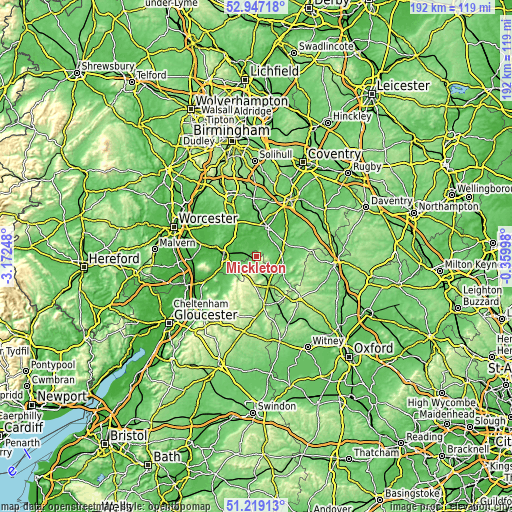
| \ | Map #1 | Topo.Map |
| Scale [m] | 46..261 m | × |
| Scale [ft] | 151..856 ft | × |
| Average | 107 m = 351 ft | × |
| Width | 6 km = 3.7 mi | 192.1 km = 119.4 mi |
| Height | 6 km = 3.7 mi | 192.1 km = 119.4 mi |
| ↑Max Latitude | 52.118512° | 52.94718° |
| Latitude at center | 52.09152° | 52.09152° |
| ↓Min Latitude | 52.064512° | 51.21913° |
| ← Min Longitude | -1.810175° | -3.17248° |
| Longitude center | -1.76623° | -1.76623° |
| →Max Longitude | -1.722285° | -0.35998° |
Nearby cities:
Cities around Mickleton sort by population:
• Stratford-upon-Avon elevation 44 m
11.8 km,  19°
19°
• Bidford-on-Avon 36 m
10.8 km,  323°
323°
• Shipston on Stour 72 m
10.1 km,  109°
109°
• Bidford-on-avon 39 m
10.4 km, 323°
• Moreton in Marsh 129 m
12.1 km,  159°
159°
• Badsey 37 m
9.1 km,  267°
267°
• Broadway 94 m
8.8 km,  227°
227°
• Chipping Campden 139 m
4.7 km,  188°
188°
• Harvington 49 m
12 km,  297°
297°
• South Littleton 43 m
8.8 km,  286°
286°
• Honeybourne 47 m
4.5 km,  275°
275°
• Blockley 156 m
8.8 km,  178°
178°
Multilingual:
 En español:
Mickleton elevación 75 m.
 En France:
Mickleton élévation 75 m.
 Auf Deutsch:
Mickleton höhe über dem Meeresspiegel ist 75 m.

Sources and notes:
- [note 1] Map square and city borders are not equal. Map elevation data is calculated only from area inside that square.
- [src 1] Elevation data from geonames database provided with same terms of usage.
- [src 2] The elevation map of Mickleton is generated using elevation data from NASA's 3 arcsec (90m) resolution SRTM data.
- [src 3] Base (background) map © OpenStreetMap contributors tiles are generated by Geofabrik and OpenTopoMap.
Copyright & License:
This Mickleton Elevation Map is licensed under CC BY-SA. You may reuse any part from this page, if you give a proper credit by linking to this URL:
 More info on terms of use page.