Beaurepaire elevation
Beaurepaire (Auvergne-Rhône-Alpes, Département de l'Isère), France elevation is 257 meters and Beaurepaire elevation in feet is 843 ft above sea level [src 1]. Beaurepaire is a populated place (feature code) with elevation that is 83 meters (272 ft) bigger than average city elevation in France.
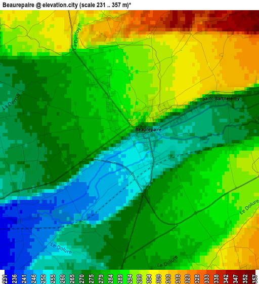
Below is the Elevation map of Beaurepaire, which displays elevation range with different colors. Scale of the first map is from 231 to 357 m (758 to 1171 ft) with average elevation of 282.5 meters (=927 ft) [note 1]
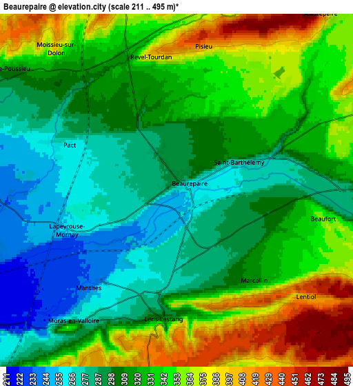
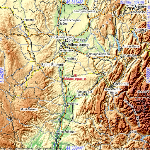
These maps also provides idea of topography and contour of this city, they are displayed at different zoom levels. More info about maps, scale and edge coordinates you can find below images.
| \ | Map #1 | Map #2 | Topo.Map |
| Scale [m] | 231..357 m | 211..495 m | × |
| Scale [ft] | 758..1171 ft | 692..1624 ft | × |
| Average | 282.5 m = 927 ft | 322.1 m = 1057 ft | × |
| Width | 6.87 km = 4.3 mi | 13.74 km = 8.5 mi | 219.8 km = 136.6 mi |
| Height | 6.87 km = 4.3 mi | 13.74 km = 8.5 mi | 219.8 km = 136.6 mi |
| ↑Max Latitude | 45.367463° | 45.398328° | 46.31646° |
| Latitude at center | 45.33658° | 45.33658° | 45.33658° |
| ↓Min Latitude | 45.305681° | 45.274764° | 44.33944° |
| ← Min Longitude | 5.004835° | 4.960889° | 3.64253° |
| Longitude center | 5.04878° | 5.04878° | 5.04878° |
| →Max Longitude | 5.092725° | 5.136671° | 6.45503° |
Nearby cities:
Cities around Beaurepaire sort by population:
• La Côte-Saint-André elevation 400 m
17.6 km,  68°
68°
• Anneyron 208 m
14.6 km,  240°
240°
• Saint-Siméon-de-Bressieux 367 m
17 km,  89°
89°
• Eyzin-Pinet 290 m
15.8 km,  345°
345°
• Châteauneuf-de-Galaure 253 m
13.8 km,  210°
210°
• Saint-Sorlin-en-Valloire 241 m
9.5 km, 235°
• Hauterives 300 m
9.3 km,  194°
194°
• Viriville 392 m
12.3 km,  100°
100°
• Épinouze 228 m
9.8 km,  252°
252°
• Ville-sous-Anjou 238 m
16 km,  284°
284°
• Vernioz 270 m
16.4 km,  307°
307°
• Sonnay 250 m
11.5 km, 281°
Multilingual:
 En español:
Beaurepaire elevación 257 m.
 En France:
Beaurepaire élévation 257 m.
 Auf Deutsch:
Beaurepaire höhe über dem Meeresspiegel ist 257 m.

Sources and notes:
- [note 1] Map square and city borders are not equal. Map elevation data is calculated only from area inside that square.
- [src 1] Elevation data from geonames database provided with same terms of usage.
- [src 2] The elevation map of Beaurepaire is generated using elevation data from NASA's 3 arcsec (90m) resolution SRTM data.
- [src 3] Base (background) map © OpenStreetMap contributors tiles are generated by Geofabrik and OpenTopoMap.
Copyright & License:
This Beaurepaire Elevation Map is licensed under CC BY-SA. You may reuse any part from this page, if you give a proper credit by linking to this URL:
 More info on terms of use page.