Eyzin-Pinet elevation
Eyzin-Pinet (Auvergne-Rhône-Alpes, Département de l'Isère), France elevation is 290 meters and Eyzin-Pinet elevation in feet is 951 ft above sea level [src 1]. Eyzin-Pinet is a populated place (feature code) with elevation that is 116 meters (381 ft) bigger than average city elevation in France.
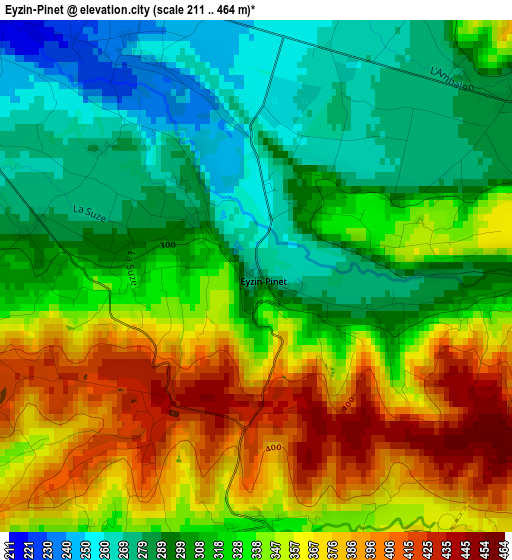
Below is the Elevation map of Eyzin-Pinet, which displays elevation range with different colors. Scale of the first map is from 211 to 464 m (692 to 1522 ft) with average elevation of 328 meters (=1076 ft) [note 1]
These maps also provides idea of topography and contour of this city, they are displayed at different zoom levels. More info about maps, scale and edge coordinates you can find below images.
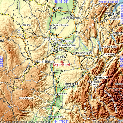
| \ | Map #1 | Topo.Map |
| Scale [m] | 211..464 m | × |
| Scale [ft] | 692..1522 ft | × |
| Average | 328 m = 1076 ft | × |
| Width | 6.85 km = 4.3 mi | 219.3 km = 136.3 mi |
| Height | 6.85 km = 4.3 mi | 219.3 km = 136.3 mi |
| ↑Max Latitude | 45.504578° | 46.45126° |
| Latitude at center | 45.47377° | 45.47377° |
| ↓Min Latitude | 45.442946° | 44.47903° |
| ← Min Longitude | 4.954505° | 3.5922° |
| Longitude center | 4.99845° | 4.99845° |
| →Max Longitude | 5.042395° | 6.4047° |
Nearby cities:
Cities around Eyzin-Pinet sort by population:
• Vienne elevation 190 m
11.2 km,  300°
300°
• Pont-Évêque 202 m
9.5 km,  313°
313°
• Saint-Jean-de-Bournay 397 m
11.3 km,  74°
74°
• Estrablin 228 m
5.4 km,  328°
328°
• Jardin 274 m
7.5 km,  289°
289°
• Les Côtes-d'Arey 303 m
10.5 km,  259°
259°
• Charantonnay 370 m
11.2 km,  51°
51°
• Septème 252 m
8.8 km,  3°
3°
• Moidieu 303 m
4.8 km,  8°
8°
• Oytier-Saint-Oblas 300 m
9.7 km,  15°
15°
• Vernioz 270 m
10.4 km,  239°
239°
• Beauvoir-de-Marc 411 m
8.1 km, 50°
Multilingual:
 En español:
Eyzin-Pinet elevación 290 m.
 En France:
Eyzin-Pinet élévation 290 m.
 Auf Deutsch:
Eyzin-Pinet höhe über dem Meeresspiegel ist 290 m.

Sources and notes:
- [note 1] Map square and city borders are not equal. Map elevation data is calculated only from area inside that square.
- [src 1] Elevation data from geonames database provided with same terms of usage.
- [src 2] The elevation map of Eyzin-Pinet is generated using elevation data from NASA's 3 arcsec (90m) resolution SRTM data.
- [src 3] Base (background) map © OpenStreetMap contributors tiles are generated by Geofabrik and OpenTopoMap.
Copyright & License:
This Eyzin-Pinet Elevation Map is licensed under CC BY-SA. You may reuse any part from this page, if you give a proper credit by linking to this URL:
 More info on terms of use page.