Vienne elevation
Vienne (Auvergne-Rhône-Alpes, Département de l'Isère), France elevation is 190 meters and Vienne elevation in feet is 623 ft above sea level [src 1]. Vienne is a seat of a third-order administrative division (feature code) with elevation that is 16 meters (52 ft) bigger than average city elevation in France.
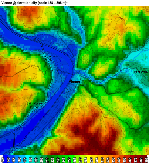
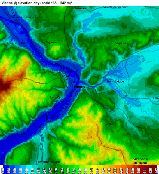
Below is the Elevation map of Vienne, which displays elevation range with different colors. Scale of the first map is from 138 to 398 m (453 to 1306 ft) with average elevation of 248.5 meters (=815 ft) [note 1]
These maps also provides idea of topography and contour of this city, they are displayed at different zoom levels. More info about maps, scale and edge coordinates you can find below images.
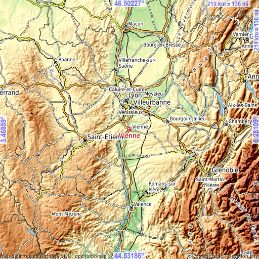
| \ | Map #1 | Map #2 | Topo.Map |
| Scale [m] | 138..398 m | 138..542 m | × |
| Scale [ft] | 453..1306 ft | 453..1778 ft | × |
| Average | 248.5 m = 815 ft | 266.7 m = 875 ft | × |
| Width | 6.85 km = 4.3 mi | 13.69 km = 8.5 mi | 219.1 km = 136.1 mi |
| Height | 6.85 km = 4.3 mi | 13.69 km = 8.5 mi | 219.1 km = 136.1 mi |
| ↑Max Latitude | 45.556469° | 45.587232° | 46.50227° |
| Latitude at center | 45.52569° | 45.52569° | 45.52569° |
| ↓Min Latitude | 45.494894° | 45.464081° | 44.53186° |
| ← Min Longitude | 4.830895° | 4.786949° | 3.46859° |
| Longitude center | 4.87484° | 4.87484° | 4.87484° |
| →Max Longitude | 4.918785° | 4.962731° | 6.28109° |
Nearby cities:
Cities around Vienne sort by population:
• Pont-Évêque elevation 202 m
2.8 km,  74°
74°
• Estrablin 228 m
6.9 km,  99°
99°
• Ampuis 155 m
6.5 km,  231°
231°
• Loire-sur-Rhône 334 m
6.4 km,  294°
294°
• Chuzelles 236 m
6.6 km,  1°
1°
• Seyssuel 305 m
4.4 km,  325°
325°
• Jardin 274 m
4.2 km,  141°
141°
• Sainte-Colombe 152 m
0.6 km,  266°
266°
• Reventin-Vaugris 303 m
7.1 km,  200°
200°
• Saint-Romain-en-Gal 152 m
1.3 km,  307°
307°
• Serpaize 257 m
4.9 km,  42°
42°
• Saint-Cyr-sur-le-Rhône 158 m
2.1 km,  237°
237°
Multilingual:
 En español:
Vienne elevación 190 m.
 En France:
Vienne élévation 190 m.


Sources and notes:
- [note 1] Map square and city borders are not equal. Map elevation data is calculated only from area inside that square.
- [src 1] Elevation data from geonames database provided with same terms of usage.
- [src 2] The elevation map of Vienne is generated using elevation data from NASA's 3 arcsec (90m) resolution SRTM data.
- [src 3] Base (background) map © OpenStreetMap contributors tiles are generated by Geofabrik and OpenTopoMap.
Copyright & License:
This Vienne Elevation Map is licensed under CC BY-SA. You may reuse any part from this page, if you give a proper credit by linking to this URL:
 More info on terms of use page.