Saint-Jean-de-Bournay elevation
Saint-Jean-de-Bournay (Auvergne-Rhône-Alpes, Département de l'Isère), France elevation is 397 meters and Saint-Jean-de-Bournay elevation in feet is 1302 ft above sea level [src 1]. Saint-Jean-de-Bournay is a populated place (feature code) with elevation that is 223 meters (732 ft) bigger than average city elevation in France.
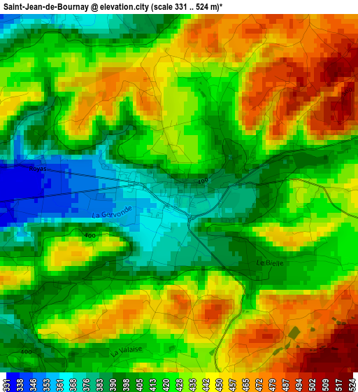
Below is the Elevation map of Saint-Jean-de-Bournay, which displays elevation range with different colors. Scale of the first map is from 331 to 524 m (1086 to 1719 ft) with average elevation of 424.6 meters (=1393 ft) [note 1]
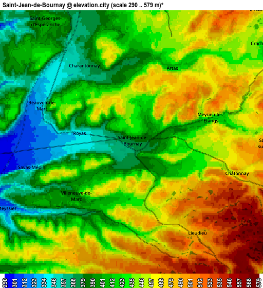
These maps also provides idea of topography and contour of this city, they are displayed at different zoom levels. More info about maps, scale and edge coordinates you can find below images.
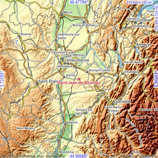
| \ | Map #1 | Map #2 | Topo.Map |
| Scale [m] | 331..524 m | 290..579 m | × |
| Scale [ft] | 1086..1719 ft | 951..1900 ft | × |
| Average | 424.6 m = 1393 ft | 434.1 m = 1424 ft | × |
| Width | 6.85 km = 4.3 mi | 13.7 km = 8.5 mi | 219.2 km = 136.2 mi |
| Height | 6.85 km = 4.3 mi | 13.7 km = 8.5 mi | 219.2 km = 136.2 mi |
| ↑Max Latitude | 45.531723° | 45.562499° | 46.47794° |
| Latitude at center | 45.50093° | 45.50093° | 45.50093° |
| ↓Min Latitude | 45.47012° | 45.439294° | 44.50666° |
| ← Min Longitude | 5.094235° | 5.050289° | 3.73193° |
| Longitude center | 5.13818° | 5.13818° | 5.13818° |
| →Max Longitude | 5.182125° | 5.226071° | 6.54443° |
Nearby cities:
Cities around Saint-Jean-de-Bournay sort by population:
• Diémoz elevation 388 m
10.7 km,  339°
339°
• Eyzin-Pinet 290 m
11.3 km,  254°
254°
• Charantonnay 370 m
4.6 km,  331°
331°
• Septème 252 m
11.8 km,  299°
299°
• Châtonnay 488 m
5.9 km,  104°
104°
• Roche 350 m
9.8 km,  11°
11°
• Moidieu 303 m
10.3 km,  279°
279°
• Maubec 439 m
12.3 km,  52°
52°
• Oytier-Saint-Oblas 300 m
10.5 km,  306°
306°
• Artas 428 m
4.5 km,  26°
26°
• Bonnefamille 330 m
11 km,  354°
354°
• Beauvoir-de-Marc 411 m
5.1 km,  294°
294°
Multilingual:
 En español:
Saint-Jean-de-Bournay elevación 397 m.
 En France:
Saint-Jean-de-Bournay élévation 397 m.
 Auf Deutsch:
Saint-Jean-de-Bournay höhe über dem Meeresspiegel ist 397 m.
 На русском:
Saint-Jean-de-Bournay высота над уровнем моря 397 м
Sources and notes:
- [note 1] Map square and city borders are not equal. Map elevation data is calculated only from area inside that square.
- [src 1] Elevation data from geonames database provided with same terms of usage.
- [src 2] The elevation map of Saint-Jean-de-Bournay is generated using elevation data from NASA's 3 arcsec (90m) resolution SRTM data.
- [src 3] Base (background) map © OpenStreetMap contributors tiles are generated by Geofabrik and OpenTopoMap.
Copyright & License:
This Saint-Jean-de-Bournay Elevation Map is licensed under CC BY-SA. You may reuse any part from this page, if you give a proper credit by linking to this URL:
 More info on terms of use page.