Septème elevation
Septème (Auvergne-Rhône-Alpes, Département de l'Isère), France elevation is 252 meters and Septème elevation in feet is 827 ft above sea level [src 1]. Septème is a populated place (feature code) with elevation that is 78 meters (256 ft) bigger than average city elevation in France.
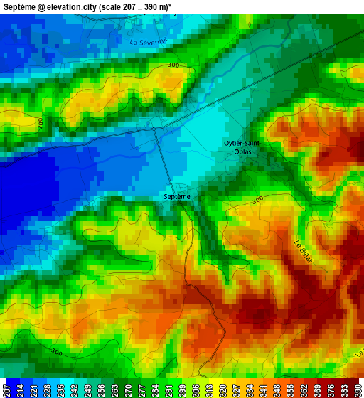
Below is the Elevation map of Septème, which displays elevation range with different colors. Scale of the first map is from 207 to 390 m (679 to 1280 ft) with average elevation of 288.4 meters (=946 ft) [note 1]
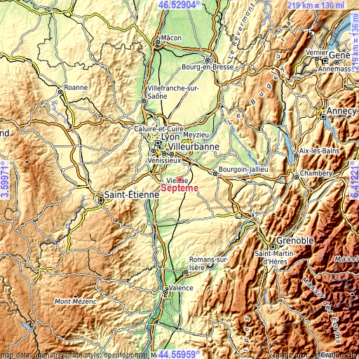
These maps also provides idea of topography and contour of this city, they are displayed at different zoom levels. More info about maps, scale and edge coordinates you can find below images.
| \ | Map #1 | Topo.Map |
| Scale [m] | 207..390 m | × |
| Scale [ft] | 679..1280 ft | × |
| Average | 288.4 m = 946 ft | × |
| Width | 6.84 km = 4.3 mi | 219 km = 136.1 mi |
| Height | 6.84 km = 4.3 mi | 219 km = 136.1 mi |
| ↑Max Latitude | 45.583704° | 46.52904° |
| Latitude at center | 45.55294° | 45.55294° |
| ↓Min Latitude | 45.522159° | 44.55959° |
| ← Min Longitude | 4.962015° | 3.59971° |
| Longitude center | 5.00596° | 5.00596° |
| →Max Longitude | 5.049905° | 6.41221° |
Nearby cities:
Cities around Septème sort by population:
• Pont-Évêque elevation 202 m
7.9 km,  252°
252°
• Estrablin 228 m
5.4 km,  219°
219°
• Saint-Just-Chaleyssin 279 m
4.6 km,  352°
352°
• Diémoz 388 m
7.7 km,  56°
56°
• Valencin 342 m
6.7 km,  15°
15°
• Luzinay 242 m
5.5 km,  318°
318°
• Charantonnay 370 m
8.3 km,  102°
102°
• Moidieu 303 m
4 km,  178°
178°
• Oytier-Saint-Oblas 300 m
2 km,  75°
75°
• Serpaize 257 m
6.9 km,  274°
274°
• Villette-de-Vienne 215 m
8.2 km,  300°
300°
• Beauvoir-de-Marc 411 m
6.8 km,  122°
122°
Multilingual:
 En español:
Septème elevación 252 m.
 En France:
Septème élévation 252 m.


Sources and notes:
- [note 1] Map square and city borders are not equal. Map elevation data is calculated only from area inside that square.
- [src 1] Elevation data from geonames database provided with same terms of usage.
- [src 2] The elevation map of Septème is generated using elevation data from NASA's 3 arcsec (90m) resolution SRTM data.
- [src 3] Base (background) map © OpenStreetMap contributors tiles are generated by Geofabrik and OpenTopoMap.
Copyright & License:
This Septème Elevation Map is licensed under CC BY-SA. You may reuse any part from this page, if you give a proper credit by linking to this URL:
 More info on terms of use page.