Luzinay elevation
Luzinay (Auvergne-Rhône-Alpes, Département de l'Isère), France elevation is 242 meters and Luzinay elevation in feet is 794 ft above sea level [src 1]. Luzinay is a populated place (feature code) with elevation that is 68 meters (223 ft) bigger than average city elevation in France.
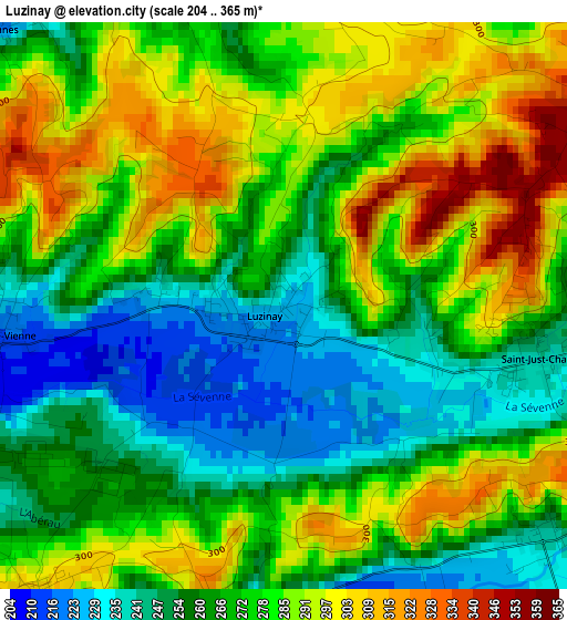
Below is the Elevation map of Luzinay, which displays elevation range with different colors. Scale of the first map is from 204 to 365 m (669 to 1198 ft) with average elevation of 273.3 meters (=897 ft) [note 1]
These maps also provides idea of topography and contour of this city, they are displayed at different zoom levels. More info about maps, scale and edge coordinates you can find below images.
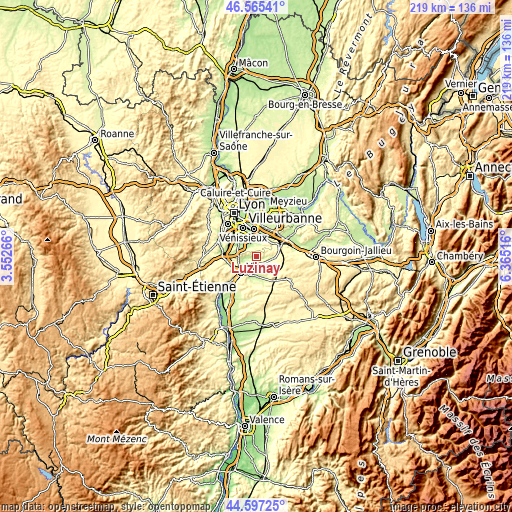
| \ | Map #1 | Topo.Map |
| Scale [m] | 204..365 m | × |
| Scale [ft] | 669..1198 ft | × |
| Average | 273.3 m = 897 ft | × |
| Width | 6.84 km = 4.3 mi | 218.8 km = 136 mi |
| Height | 6.84 km = 4.3 mi | 218.8 km = 136 mi |
| ↑Max Latitude | 45.620704° | 46.56541° |
| Latitude at center | 45.58996° | 45.58996° |
| ↓Min Latitude | 45.559199° | 44.59725° |
| ← Min Longitude | 4.914965° | 3.55266° |
| Longitude center | 4.95891° | 4.95891° |
| →Max Longitude | 5.002855° | 6.36516° |
Nearby cities:
Cities around Luzinay sort by population:
• Pont-Évêque elevation 202 m
7.5 km,  211°
211°
• Chaponnay 240 m
4.5 km,  337°
337°
• Saint-Just-Chaleyssin 279 m
3.1 km,  81°
81°
• Valencin 342 m
6 km,  66°
66°
• Toussieu 242 m
7.4 km,  15°
15°
• Chuzelles 236 m
6.4 km,  264°
264°
• Septème 252 m
5.5 km,  138°
138°
• Marennes 234 m
5 km,  313°
313°
• Oytier-Saint-Oblas 300 m
6.7 km,  122°
122°
• Serpaize 257 m
4.8 km,  222°
222°
• Simandres 196 m
7.4 km,  296°
296°
• Villette-de-Vienne 215 m
3.4 km,  270°
270°
Multilingual:
 En español:
Luzinay elevación 242 m.
 En France:
Luzinay élévation 242 m.


Sources and notes:
- [note 1] Map square and city borders are not equal. Map elevation data is calculated only from area inside that square.
- [src 1] Elevation data from geonames database provided with same terms of usage.
- [src 2] The elevation map of Luzinay is generated using elevation data from NASA's 3 arcsec (90m) resolution SRTM data.
- [src 3] Base (background) map © OpenStreetMap contributors tiles are generated by Geofabrik and OpenTopoMap.
Copyright & License:
This Luzinay Elevation Map is licensed under CC BY-SA. You may reuse any part from this page, if you give a proper credit by linking to this URL:
 More info on terms of use page.