Betz elevation
Betz (Hauts-de-France, Département de l'Oise), France elevation is 96 meters and Betz elevation in feet is 315 ft above sea level [src 1]. Betz is a populated place (feature code) with elevation that is 78 meters (256 ft) smaller than average city elevation in France.
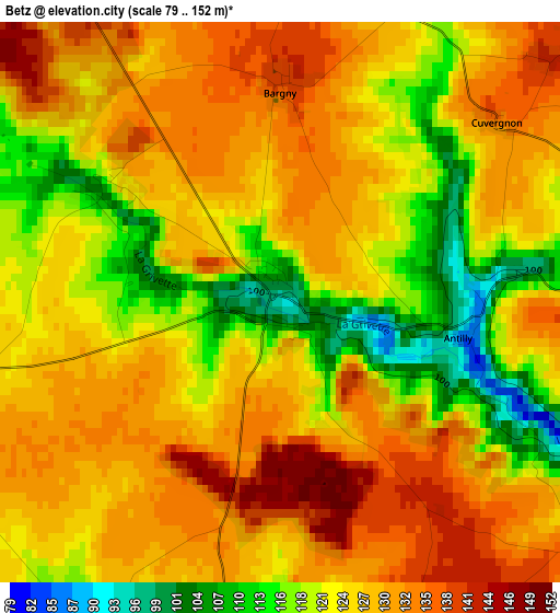
Below is the Elevation map of Betz, which displays elevation range with different colors. Scale of the first map is from 79 to 152 m (259 to 499 ft) with average elevation of 125.5 meters (=412 ft) [note 1]
These maps also provides idea of topography and contour of this city, they are displayed at different zoom levels. More info about maps, scale and edge coordinates you can find below images.
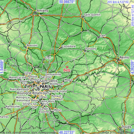
| \ | Map #1 | Topo.Map |
| Scale [m] | 79..152 m | × |
| Scale [ft] | 259..499 ft | × |
| Average | 125.5 m = 412 ft | × |
| Width | 6.39 km = 4 mi | 204.5 km = 127.1 mi |
| Height | 6.39 km = 4 mi | 204.5 km = 127.1 mi |
| ↑Max Latitude | 49.184312° | 50.06675° |
| Latitude at center | 49.15558° | 49.15558° |
| ↓Min Latitude | 49.126831° | 48.22733° |
| ← Min Longitude | 2.911895° | 1.54959° |
| Longitude center | 2.95584° | 2.95584° |
| →Max Longitude | 2.999785° | 4.36209° |
Nearby cities:
Cities around Betz sort by population:
• Crépy-en-Valois elevation 98 m
10 km,  330°
330°
• Villers-Cotterêts 132 m
14.6 km,  41°
41°
• Saint-Pathus 101 m
14.8 km,  230°
230°
• Lizy-sur-Ourcq 58 m
15.3 km,  161°
161°
• Nanteuil-le-Haudouin 92 m
10.6 km,  261°
261°
• La Ferté-Milon 98 m
12.8 km,  80°
80°
• Oissery 92 m
13.8 km, 226°
• Crouy-sur-Ourcq 65 m
11.4 km,  130°
130°
• Mareuil-sur-Ourcq 66 m
9.1 km,  102°
102°
• Silly-le-Long 125 m
13 km,  245°
245°
• Péroy-les-Gombries 130 m
8.1 km,  275°
275°
• Vaumoise 106 m
9 km,  11°
11°
Multilingual:
 En español:
Betz elevación 96 m.
 En France:
Betz élévation 96 m.


Sources and notes:
- [note 1] Map square and city borders are not equal. Map elevation data is calculated only from area inside that square.
- [src 1] Elevation data from geonames database provided with same terms of usage.
- [src 2] The elevation map of Betz is generated using elevation data from NASA's 3 arcsec (90m) resolution SRTM data.
- [src 3] Base (background) map © OpenStreetMap contributors tiles are generated by Geofabrik and OpenTopoMap.
Copyright & License:
This Betz Elevation Map is licensed under CC BY-SA. You may reuse any part from this page, if you give a proper credit by linking to this URL:
 More info on terms of use page.