Villers-Cotterêts elevation
Villers-Cotterêts (Hauts-de-France, Département de l'Aisne), France elevation is 132 meters and Villers-Cotterêts elevation in feet is 433 ft above sea level [src 1]. Villers-Cotterêts is a populated place (feature code) with elevation that is 42 meters (138 ft) smaller than average city elevation in France.
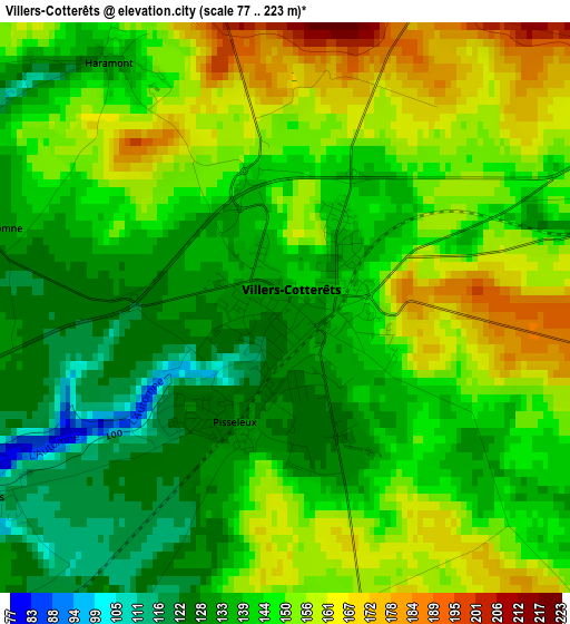
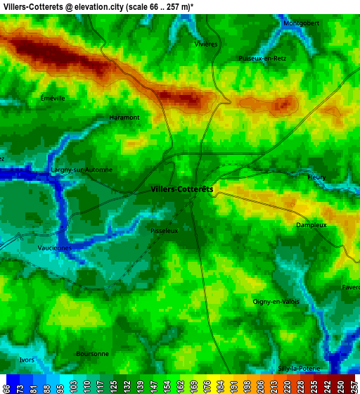
Below is the Elevation map of Villers-Cotterêts, which displays elevation range with different colors. Scale of the first map is from 77 to 223 m (253 to 732 ft) with average elevation of 145.1 meters (=476 ft) [note 1]
These maps also provides idea of topography and contour of this city, they are displayed at different zoom levels. More info about maps, scale and edge coordinates you can find below images.
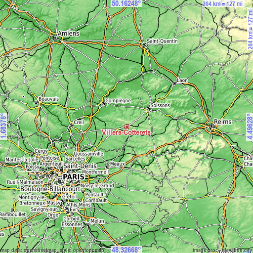
| \ | Map #1 | Map #2 | Topo.Map |
| Scale [m] | 77..223 m | 66..257 m | × |
| Scale [ft] | 253..732 ft | 217..843 ft | × |
| Average | 145.1 m = 476 ft | 145.9 m = 479 ft | × |
| Width | 6.38 km = 4 mi | 12.76 km = 7.9 mi | 204.1 km = 126.8 mi |
| Height | 6.38 km = 4 mi | 12.76 km = 7.9 mi | 204.1 km = 126.8 mi |
| ↑Max Latitude | 49.281786° | 49.310445° | 50.16248° |
| Latitude at center | 49.25311° | 49.25311° | 49.25311° |
| ↓Min Latitude | 49.224418° | 49.195709° | 48.32668° |
| ← Min Longitude | 3.046085° | 3.002139° | 1.68378° |
| Longitude center | 3.09003° | 3.09003° | 3.09003° |
| →Max Longitude | 3.133975° | 3.177921° | 4.49628° |
Nearby cities:
Cities around Villers-Cotterêts sort by population:
• Crépy-en-Valois elevation 98 m
14.8 km,  261°
261°
• Cuise-la-Motte 48 m
16 km,  337°
337°
• La Ferté-Milon 98 m
9.2 km,  162°
162°
• Pierrefonds 84 m
13.4 km,  322°
322°
• Neuilly-Saint-Front 114 m
15.6 km,  126°
126°
• Attichy 42 m
17.8 km,  350°
350°
• Vic-sur-Aisne 46 m
17.1 km,  5°
5°
• Mareuil-sur-Ourcq 66 m
12.9 km,  183°
183°
• Ambleny 55 m
15.8 km,  25°
25°
• Morienval 91 m
13.2 km,  291°
291°
• Betz 96 m
14.6 km,  221°
221°
• Vaumoise 106 m
8.2 km, 255°
Multilingual:
 En español:
Villers-Cotterêts elevación 132 m.
 En France:
Villers-Cotterêts élévation 132 m.
 Auf Deutsch:
Villers-Cotterêts höhe über dem Meeresspiegel ist 132 m.

Sources and notes:
- [note 1] Map square and city borders are not equal. Map elevation data is calculated only from area inside that square.
- [src 1] Elevation data from geonames database provided with same terms of usage.
- [src 2] The elevation map of Villers-Cotterêts is generated using elevation data from NASA's 3 arcsec (90m) resolution SRTM data.
- [src 3] Base (background) map © OpenStreetMap contributors tiles are generated by Geofabrik and OpenTopoMap.
Copyright & License:
This Villers-Cotterêts Elevation Map is licensed under CC BY-SA. You may reuse any part from this page, if you give a proper credit by linking to this URL:
 More info on terms of use page.