La Ferté-Milon elevation
La Ferté-Milon (Hauts-de-France, Département de l'Aisne), France elevation is 98 meters and La Ferté-Milon elevation in feet is 322 ft above sea level [src 1]. La Ferté-Milon is a populated place (feature code) with elevation that is 76 meters (249 ft) smaller than average city elevation in France.
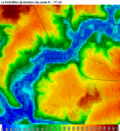
Below is the Elevation map of La Ferté-Milon, which displays elevation range with different colors. Scale of the first map is from 61 to 171 m (200 to 561 ft) with average elevation of 113.6 meters (=373 ft) [note 1]
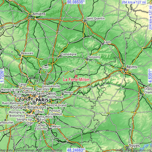
These maps also provides idea of topography and contour of this city, they are displayed at different zoom levels. More info about maps, scale and edge coordinates you can find below images.
| \ | Map #1 | Topo.Map |
| Scale [m] | 61..171 m | × |
| Scale [ft] | 200..561 ft | × |
| Average | 113.6 m = 373 ft | × |
| Width | 6.39 km = 4 mi | 204.4 km = 127 mi |
| Height | 6.39 km = 4 mi | 204.4 km = 127 mi |
| ↑Max Latitude | 49.203251° | 50.08535° |
| Latitude at center | 49.17453° | 49.17453° |
| ↓Min Latitude | 49.145792° | 48.24663° |
| ← Min Longitude | 3.084905° | 1.7226° |
| Longitude center | 3.12885° | 3.12885° |
| →Max Longitude | 3.172795° | 4.5351° |
Nearby cities:
Cities around La Ferté-Milon sort by population:
• Crépy-en-Valois elevation 98 m
18.7 km,  290°
290°
• Villers-Cotterêts 132 m
9.2 km,  342°
342°
• Lizy-sur-Ourcq 58 m
18.4 km,  205°
205°
• Neuilly-Saint-Front 114 m
9.8 km,  92°
92°
• Crouy-sur-Ourcq 65 m
10.2 km,  202°
202°
• Mareuil-sur-Ourcq 66 m
5.5 km,  221°
221°
• Mary-sur-Marne 60 m
19.1 km, 202°
• Montreuil-aux-Lions 141 m
17.7 km,  164°
164°
• Morienval 91 m
20.4 km,  312°
312°
• Péroy-les-Gombries 130 m
20.6 km,  266°
266°
• Betz 96 m
12.8 km,  260°
260°
• Vaumoise 106 m
12.7 km,  302°
302°
Multilingual:
 En español:
La Ferté-Milon elevación 98 m.
 En France:
la ferté Milon élévation 98 m.
 Auf Deutsch:
La Ferté-Milon höhe über dem Meeresspiegel ist 98 m.

Sources and notes:
- [note 1] Map square and city borders are not equal. Map elevation data is calculated only from area inside that square.
- [src 1] Elevation data from geonames database provided with same terms of usage.
- [src 2] The elevation map of La Ferté-Milon is generated using elevation data from NASA's 3 arcsec (90m) resolution SRTM data.
- [src 3] Base (background) map © OpenStreetMap contributors tiles are generated by Geofabrik and OpenTopoMap.
Copyright & License:
This La Ferté-Milon Elevation Map is licensed under CC BY-SA. You may reuse any part from this page, if you give a proper credit by linking to this URL:
 More info on terms of use page.