Saint-Pathus elevation
Saint-Pathus (Île-de-France, Seine-et-Marne), France elevation is 101 meters and Saint-Pathus elevation in feet is 331 ft above sea level [src 1]. Saint-Pathus is a populated place (feature code) with elevation that is 73 meters (240 ft) smaller than average city elevation in France.
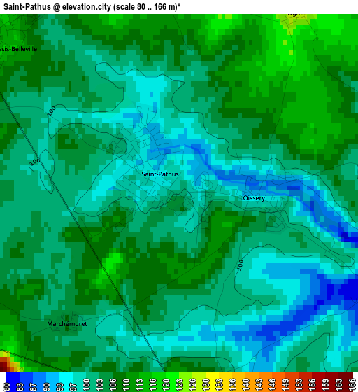
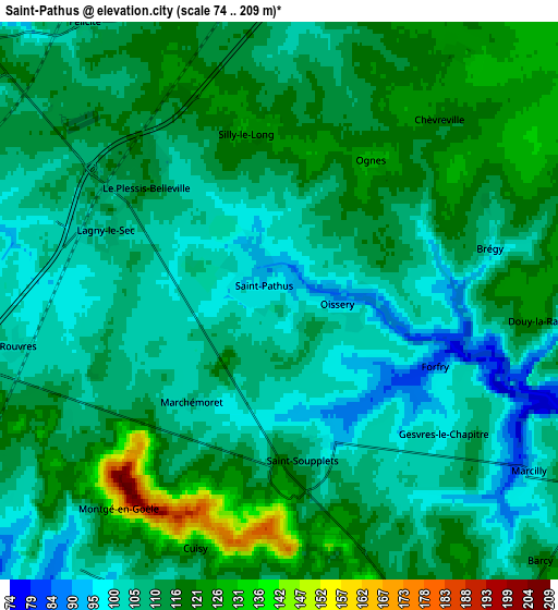
Below is the Elevation map of Saint-Pathus, which displays elevation range with different colors. Scale of the first map is from 80 to 166 m (262 to 545 ft) with average elevation of 103.4 meters (=339 ft) [note 1]
These maps also provides idea of topography and contour of this city, they are displayed at different zoom levels. More info about maps, scale and edge coordinates you can find below images.
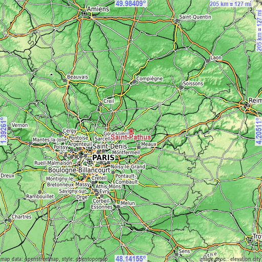
| \ | Map #1 | Map #2 | Topo.Map |
| Scale [m] | 80..166 m | 74..209 m | × |
| Scale [ft] | 262..545 ft | 243..686 ft | × |
| Average | 103.4 m = 339 ft | 110.8 m = 364 ft | × |
| Width | 6.4 km = 4 mi | 12.8 km = 8 mi | 204.9 km = 127.3 mi |
| Height | 6.4 km = 4 mi | 12.8 km = 8 mi | 204.9 km = 127.3 mi |
| ↑Max Latitude | 49.100141° | 49.128905° | 49.98409° |
| Latitude at center | 49.07136° | 49.07136° | 49.07136° |
| ↓Min Latitude | 49.042562° | 49.013748° | 48.14155° |
| ← Min Longitude | 2.754915° | 2.710969° | 1.39261° |
| Longitude center | 2.79886° | 2.79886° | 2.79886° |
| →Max Longitude | 2.842805° | 2.886751° | 4.20511° |
Nearby cities:
Cities around Saint-Pathus sort by population:
• Dammartin-en-Goële elevation 171 m
9 km,  257°
257°
• Othis 111 m
9 km,  271°
271°
• Saint-Mard 110 m
8.4 km,  242°
242°
• Nanteuil-le-Haudouin 92 m
7.8 km,  6°
6°
• Saint-Soupplets 105 m
3.7 km,  170°
170°
• Le Plessis-Belleville 115 m
4.1 km,  310°
310°
• Oissery 92 m
1.4 km,  94°
94°
• Juilly 87 m
9.3 km,  226°
226°
• Lagny-le-Sec 107 m
4.3 km,  294°
294°
• Monthyon 161 m
7.4 km,  164°
164°
• Silly-le-Long 125 m
4 km,  353°
353°
• Ver-sur-Launette 94 m
9.2 km, 294°
Multilingual:
 En español:
Saint-Pathus elevación 101 m.
 En France:
Saint-Pathus élévation 101 m.
 Auf Deutsch:
Saint-Pathus höhe über dem Meeresspiegel ist 101 m.

Sources and notes:
- [note 1] Map square and city borders are not equal. Map elevation data is calculated only from area inside that square.
- [src 1] Elevation data from geonames database provided with same terms of usage.
- [src 2] The elevation map of Saint-Pathus is generated using elevation data from NASA's 3 arcsec (90m) resolution SRTM data.
- [src 3] Base (background) map © OpenStreetMap contributors tiles are generated by Geofabrik and OpenTopoMap.
Copyright & License:
This Saint-Pathus Elevation Map is licensed under CC BY-SA. You may reuse any part from this page, if you give a proper credit by linking to this URL:
 More info on terms of use page.