Darney elevation
Darney (Grand Est, Vosges), France elevation is 271 meters and Darney elevation in feet is 889 ft above sea level [src 1]. Darney is a populated place (feature code) with elevation that is 97 meters (318 ft) bigger than average city elevation in France.
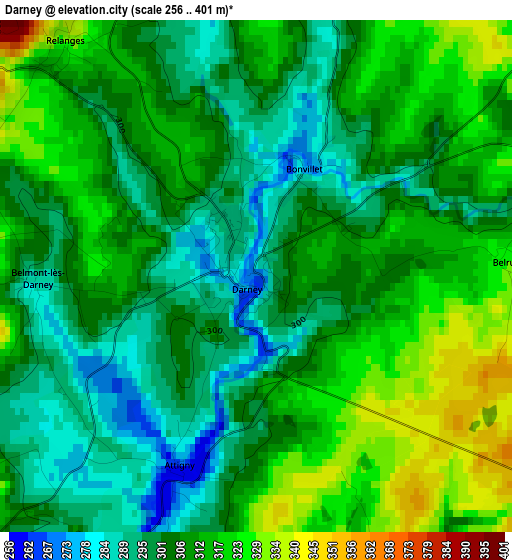
Below is the Elevation map of Darney, which displays elevation range with different colors. Scale of the first map is from 256 to 401 m (840 to 1316 ft) with average elevation of 307.4 meters (=1009 ft) [note 1]
These maps also provides idea of topography and contour of this city, they are displayed at different zoom levels. More info about maps, scale and edge coordinates you can find below images.
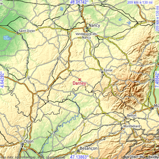
| \ | Map #1 | Topo.Map |
| Scale [m] | 256..401 m | × |
| Scale [ft] | 840..1316 ft | × |
| Average | 307.4 m = 1009 ft | × |
| Width | 6.53 km = 4.1 mi | 208.9 km = 129.8 mi |
| Height | 6.53 km = 4.1 mi | 208.9 km = 129.8 mi |
| ↑Max Latitude | 48.115947° | 49.01742° |
| Latitude at center | 48.0866° | 48.0866° |
| ↓Min Latitude | 48.057236° | 47.13863° |
| ← Min Longitude | 6.005225° | 4.64292° |
| Longitude center | 6.04917° | 6.04917° |
| →Max Longitude | 6.093115° | 7.45542° |
Nearby cities:
Cities around Darney sort by population:
• Mirecourt elevation 282 m
24.6 km,  14°
14°
• Vittel 337 m
14.7 km,  329°
329°
• Contrexéville 350 m
15.7 km,  313°
313°
• Bourbonne-les-Bains 273 m
26.9 km,  236°
236°
• Les Forges 371 m
27.1 km,  68°
68°
• Uxegney 338 m
26.7 km,  62°
62°
• Bains-les-Bains 309 m
18.6 km,  120°
120°
• Bulgnéville 351 m
20.8 km, 310°
• Uriménil 363 m
26.1 km,  86°
86°
• Lamarche 359 m
20 km,  264°
264°
• Darnieulles 355 m
25.6 km, 60°
• Uzemain 332 m
21.9 km, 90°
Multilingual:
 En español:
Darney elevación 271 m.
 En France:
Darney élévation 271 m.


Sources and notes:
- [note 1] Map square and city borders are not equal. Map elevation data is calculated only from area inside that square.
- [src 1] Elevation data from geonames database provided with same terms of usage.
- [src 2] The elevation map of Darney is generated using elevation data from NASA's 3 arcsec (90m) resolution SRTM data.
- [src 3] Base (background) map © OpenStreetMap contributors tiles are generated by Geofabrik and OpenTopoMap.
Copyright & License:
This Darney Elevation Map is licensed under CC BY-SA. You may reuse any part from this page, if you give a proper credit by linking to this URL:
 More info on terms of use page.