Mirecourt elevation
Mirecourt (Grand Est, Vosges), France elevation is 282 meters and Mirecourt elevation in feet is 925 ft above sea level [src 1]. Mirecourt is a populated place (feature code) with elevation that is 108 meters (354 ft) bigger than average city elevation in France.
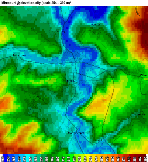
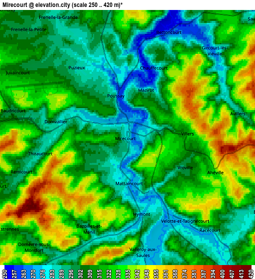
Below is the Elevation map of Mirecourt, which displays elevation range with different colors. Scale of the first map is from 254 to 392 m (833 to 1286 ft) with average elevation of 305.2 meters (=1001 ft) [note 1]
These maps also provides idea of topography and contour of this city, they are displayed at different zoom levels. More info about maps, scale and edge coordinates you can find below images.
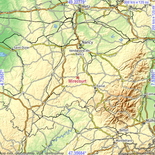
| \ | Map #1 | Map #2 | Topo.Map |
| Scale [m] | 254..392 m | 250..420 m | × |
| Scale [ft] | 833..1286 ft | 820..1378 ft | × |
| Average | 305.2 m = 1001 ft | 314 m = 1030 ft | × |
| Width | 6.5 km = 4 mi | 13 km = 8.1 mi | 208 km = 129.2 mi |
| Height | 6.5 km = 4 mi | 13 km = 8.1 mi | 208 km = 129.2 mi |
| ↑Max Latitude | 48.330115° | 48.359323° | 49.22779° |
| Latitude at center | 48.30089° | 48.30089° | 48.30089° |
| ↓Min Latitude | 48.271648° | 48.24239° | 47.35684° |
| ← Min Longitude | 6.088875° | 6.044929° | 4.72657° |
| Longitude center | 6.13282° | 6.13282° | 6.13282° |
| →Max Longitude | 6.176765° | 6.220711° | 7.53907° |
Nearby cities:
Cities around Mirecourt sort by population:
• Thaon-les-Vosges elevation 302 m
21.8 km,  105°
105°
• Vittel 337 m
17.6 km,  230°
230°
• Charmes 282 m
14.1 km,  55°
55°
• Contrexéville 350 m
21.8 km, 233°
• Nomexy 284 m
18.7 km,  87°
87°
• Vincey 296 m
15.2 km,  74°
74°
• Uxegney 338 m
21 km,  123°
123°
• Châtel-sur-Moselle 303 m
19.4 km, 85°
• Vézelise 257 m
21 km,  350°
350°
• Portieux 296 m
16.4 km, 72°
• Darnieulles 355 m
19.6 km,  125°
125°
• Igney 308 m
19.8 km,  98°
98°
Multilingual:
 En español:
Mirecourt elevación 282 m.
 En France:
Mirecourt élévation 282 m.
 Auf Deutsch:
Mirecourt höhe über dem Meeresspiegel ist 282 m.

Sources and notes:
- [note 1] Map square and city borders are not equal. Map elevation data is calculated only from area inside that square.
- [src 1] Elevation data from geonames database provided with same terms of usage.
- [src 2] The elevation map of Mirecourt is generated using elevation data from NASA's 3 arcsec (90m) resolution SRTM data.
- [src 3] Base (background) map © OpenStreetMap contributors tiles are generated by Geofabrik and OpenTopoMap.
Copyright & License:
This Mirecourt Elevation Map is licensed under CC BY-SA. You may reuse any part from this page, if you give a proper credit by linking to this URL:
 More info on terms of use page.