Varzy elevation
Varzy (Bourgogne-Franche-Comté, Département de la Nièvre), France elevation is 222 meters and Varzy elevation in feet is 728 ft above sea level [src 1]. Varzy is a populated place (feature code) with elevation that is 48 meters (157 ft) bigger than average city elevation in France.
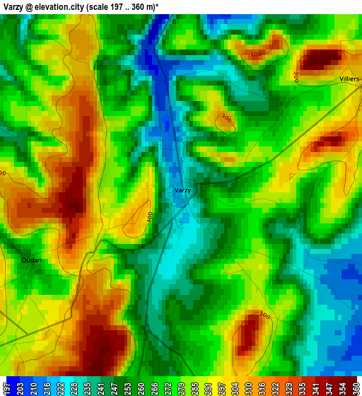
Below is the Elevation map of Varzy, which displays elevation range with different colors. Scale of the first map is from 197 to 360 m (646 to 1181 ft) with average elevation of 273 meters (=896 ft) [note 1]
These maps also provides idea of topography and contour of this city, they are displayed at different zoom levels. More info about maps, scale and edge coordinates you can find below images.
| \ | Map #1 | Topo.Map |
| Scale [m] | 197..360 m | × |
| Scale [ft] | 646..1181 ft | × |
| Average | 273 m = 896 ft | × |
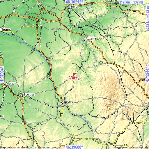
| Width | 6.62 km = 4.1 mi | 211.8 km = 131.6 mi |
| Height | 6.62 km = 4.1 mi | 211.8 km = 131.6 mi |
| ↑Max Latitude | 47.387861° | 48.30212° |
| Latitude at center | 47.3581° | 47.3581° |
| ↓Min Latitude | 47.328322° | 46.39688° |
| ← Min Longitude | 3.342245° | 1.97994° |
| Longitude center | 3.38619° | 3.38619° |
| →Max Longitude | 3.430135° | 4.79244° |
Nearby cities:
Cities around Varzy sort by population:
• Cosne-Cours-sur-Loire elevation 149 m
35.2 km,  279°
279°
• La Charité-sur-Loire 187 m
34 km,  235°
235°
• Clamecy 190 m
15.1 km,  41°
41°
• Guérigny 226 m
33.2 km,  204°
204°
• Prémery 233 m
21.4 km,  191°
191°
• Corbigny 200 m
25 km,  116°
116°
• Pouilly-sur-Loire 166 m
33.6 km,  255°
255°
• Donzy 180 m
19.7 km,  274°
274°
• Saint-Amand-en-Puisaye 187 m
30.2 km,  309°
309°
• Lormes 424 m
33.4 km,  103°
103°
• Chaulgnes 226 m
33.2 km,  219°
219°
• Herry 161 m
36.2 km, 244°
Multilingual:
 En español:
Varzy elevación 222 m.
 En France:
Varzy élévation 222 m.


Sources and notes:
- [note 1] Map square and city borders are not equal. Map elevation data is calculated only from area inside that square.
- [src 1] Elevation data from geonames database provided with same terms of usage.
- [src 2] The elevation map of Varzy is generated using elevation data from NASA's 3 arcsec (90m) resolution SRTM data.
- [src 3] Base (background) map © OpenStreetMap contributors tiles are generated by Geofabrik and OpenTopoMap.
Copyright & License:
This Varzy Elevation Map is licensed under CC BY-SA. You may reuse any part from this page, if you give a proper credit by linking to this URL:
 More info on terms of use page.