Taberno elevation
Taberno (Andalusia, Almería), Spain elevation is 713 meters and Taberno elevation in feet is 2339 ft above sea level [src 1]. Taberno is a seat of a third-order administrative division (feature code) with elevation that is 110 meters (361 ft) bigger than average city elevation in Spain.
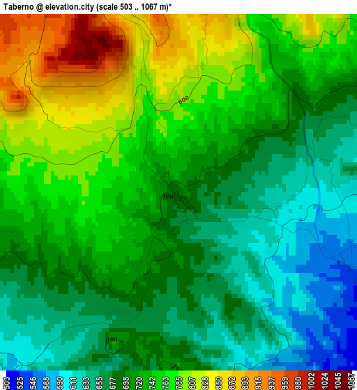
Below is the Elevation map of Taberno, which displays elevation range with different colors. Scale of the first map is from 503 to 1067 m (1650 to 3501 ft) with average elevation of 721 meters (=2365 ft) [note 1]
These maps also provides idea of topography and contour of this city, they are displayed at different zoom levels. More info about maps, scale and edge coordinates you can find below images.
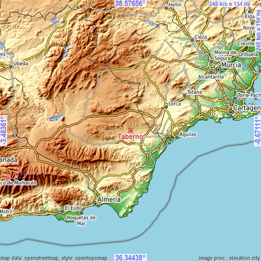
| \ | Map #1 | Topo.Map |
| Scale [m] | 503..1067 m | × |
| Scale [ft] | 1650..3501 ft | × |
| Average | 721 m = 2365 ft | × |
| Width | 7.76 km = 4.8 mi | 248.2 km = 154.2 mi |
| Height | 7.76 km = 4.8 mi | 248.2 km = 154.2 mi |
| ↑Max Latitude | 37.503671° | 38.57656° |
| Latitude at center | 37.4688° | 37.4688° |
| ↓Min Latitude | 37.433913° | 36.34438° |
| ← Min Longitude | -2.121305° | -3.48361° |
| Longitude center | -2.07736° | -2.07736° |
| →Max Longitude | -2.033415° | -0.67111° |
Nearby cities:
Cities around Taberno sort by population:
• Huércal-Overa elevation 286 m
14.8 km,  126°
126°
• Albox 428 m
11 km,  215°
215°
• Velez Rubio 828 m
20 km,  0°
0°
• Olula del Río 488 m
23.2 km,  236°
236°
• Cantoria 380 m
16.5 km, 217°
• Arboleas 296 m
13.2 km,  178°
178°
• Oria 1028 m
19.1 km,  275°
275°
• Zurgena 244 m
14.5 km,  166°
166°
• Fines 476 m
20 km,  233°
233°
• Chirivel 1046 m
21.9 km,  309°
309°
• Albánchez 503 m
22.6 km,  204°
204°
• Partaloa 540 m
14.7 km, 242°
Multilingual:
 En español:
Taberno elevación 713 m.
 En France:
Taberno élévation 713 m.


Sources and notes:
- [note 1] Map square and city borders are not equal. Map elevation data is calculated only from area inside that square.
- [src 1] Elevation data from geonames database provided with same terms of usage.
- [src 2] The elevation map of Taberno is generated using elevation data from NASA's 3 arcsec (90m) resolution SRTM data.
- [src 3] Base (background) map © OpenStreetMap contributors tiles are generated by Geofabrik and OpenTopoMap.
Copyright & License:
This Taberno Elevation Map is licensed under CC BY-SA. You may reuse any part from this page, if you give a proper credit by linking to this URL:
 More info on terms of use page.