Arboleas elevation
Arboleas (Andalusia, Almería), Spain elevation is 296 meters and Arboleas elevation in feet is 971 ft above sea level [src 1]. Arboleas is a seat of a third-order administrative division (feature code) with elevation that is 307 meters (1007 ft) smaller than average city elevation in Spain.
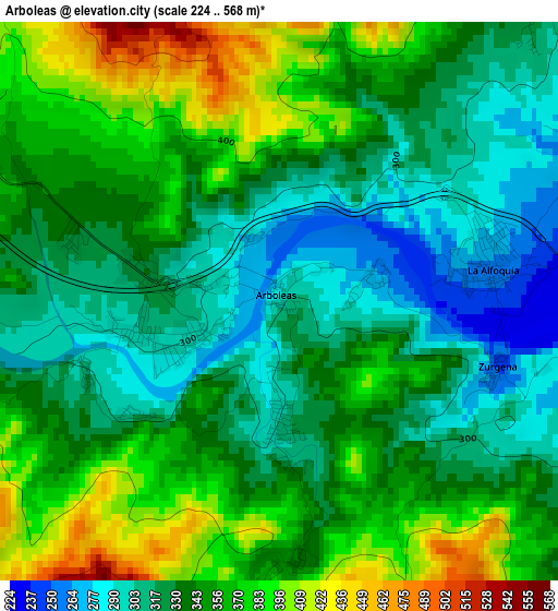
Below is the Elevation map of Arboleas, which displays elevation range with different colors. Scale of the first map is from 224 to 568 m (735 to 1864 ft) with average elevation of 342.3 meters (=1123 ft) [note 1]
These maps also provides idea of topography and contour of this city, they are displayed at different zoom levels. More info about maps, scale and edge coordinates you can find below images.
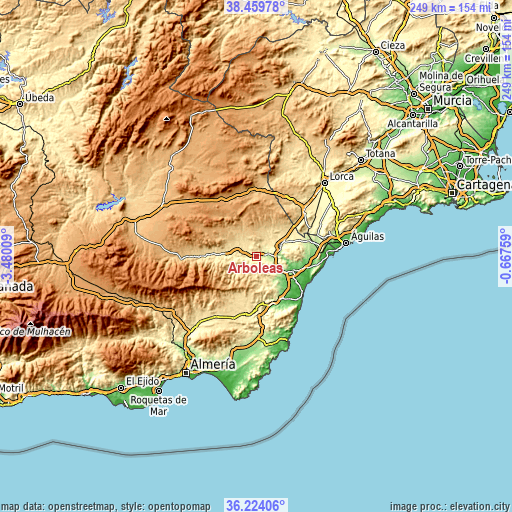
| \ | Map #1 | Topo.Map |
| Scale [m] | 224..568 m | × |
| Scale [ft] | 735..1864 ft | × |
| Average | 342.3 m = 1123 ft | × |
| Width | 7.77 km = 4.8 mi | 248.6 km = 154.5 mi |
| Height | 7.77 km = 4.8 mi | 248.6 km = 154.5 mi |
| ↑Max Latitude | 37.385166° | 38.45978° |
| Latitude at center | 37.35024° | 37.35024° |
| ↓Min Latitude | 37.315298° | 36.22406° |
| ← Min Longitude | -2.117785° | -3.48009° |
| Longitude center | -2.07384° | -2.07384° |
| →Max Longitude | -2.029895° | -0.66759° |
Nearby cities:
Cities around Arboleas sort by population:
• Huércal-Overa elevation 286 m
12.3 km,  69°
69°
• Cuevas del Almanzora 46 m
18 km,  109°
109°
• Albox 428 m
7.9 km,  302°
302°
• Cantoria 380 m
10.5 km,  270°
270°
• Antas 108 m
18.1 km,  130°
130°
• Zurgena 244 m
3.1 km, 106°
• Fines 476 m
16.3 km, 274°
• Lubrín 519 m
15 km,  177°
177°
• Albánchez 503 m
12.1 km,  232°
232°
• Partaloa 540 m
14.8 km, 295°
• Cóbdar 620 m
15.6 km, 230°
• Taberno 713 m
13.2 km,  358°
358°
Multilingual:
 En español:
Arboleas elevación 296 m.
 En France:
Arboleas élévation 296 m.
 Auf Deutsch:
Arboleas höhe über dem Meeresspiegel ist 296 m.

Sources and notes:
- [note 1] Map square and city borders are not equal. Map elevation data is calculated only from area inside that square.
- [src 1] Elevation data from geonames database provided with same terms of usage.
- [src 2] The elevation map of Arboleas is generated using elevation data from NASA's 3 arcsec (90m) resolution SRTM data.
- [src 3] Base (background) map © OpenStreetMap contributors tiles are generated by Geofabrik and OpenTopoMap.
Copyright & License:
This Arboleas Elevation Map is licensed under CC BY-SA. You may reuse any part from this page, if you give a proper credit by linking to this URL:
 More info on terms of use page.