Murgia elevation
Murgia (Basque Country, Araba / Álava), Spain elevation is 617 meters and Murgia elevation in feet is 2024 ft above sea level [src 1]. Murgia is a populated place (feature code) with elevation that is 14 meters (46 ft) bigger than average city elevation in Spain.
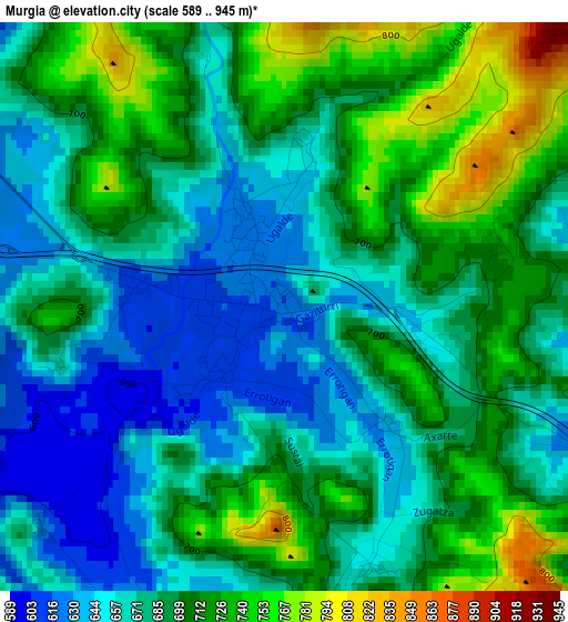
Below is the Elevation map of Murgia, which displays elevation range with different colors. Scale of the first map is from 589 to 945 m (1932 to 3100 ft) with average elevation of 688.9 meters (=2260 ft) [note 1]
These maps also provides idea of topography and contour of this city, they are displayed at different zoom levels. More info about maps, scale and edge coordinates you can find below images.
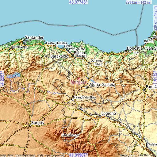
| \ | Map #1 | Topo.Map |
| Scale [m] | 589..945 m | × |
| Scale [ft] | 1932..3100 ft | × |
| Average | 688.9 m = 2260 ft | × |
| Width | 7.15 km = 4.4 mi | 228.9 km = 142.2 mi |
| Height | 7.15 km = 4.4 mi | 228.9 km = 142.2 mi |
| ↑Max Latitude | 42.989014° | 43.97743° |
| Latitude at center | 42.95686° | 42.95686° |
| ↓Min Latitude | 42.924689° | 41.91907° |
| ← Min Longitude | -2.863395° | -4.2257° |
| Longitude center | -2.81945° | -2.81945° |
| →Max Longitude | -2.775505° | -1.4132° |
Nearby cities:
Cities around Murgia sort by population:
• Gasteiz / Vitoria elevation 547 m
16.9 km,  134°
134°
• Laudio / Llodio 125 m
23.7 km,  330°
330°
• Amurrio 219 m
18 km,  305°
305°
• Urduña / Orduña 293 m
16 km,  285°
285°
• Lezama 347 m
14.8 km,  302°
302°
• Zeanuri 168 m
16.9 km,  19°
19°
• Elexalde 183 m
23.4 km,  336°
336°
• Berberana 609 m
20.1 km,  257°
257°
• Leintz-Gatzaga 457 m
20.7 km,  80°
80°
• Areatza 141 m
18.3 km,  13°
13°
• Otxandio 580 m
16.2 km,  58°
58°
• Ubide 571 m
13.1 km, 55°
Multilingual:
 En español:
Murguía elevación 617 m.
 En France:
Murgia élévation 617 m.


Sources and notes:
- [note 1] Map square and city borders are not equal. Map elevation data is calculated only from area inside that square.
- [src 1] Elevation data from geonames database provided with same terms of usage.
- [src 2] The elevation map of Murgia is generated using elevation data from NASA's 3 arcsec (90m) resolution SRTM data.
- [src 3] Base (background) map © OpenStreetMap contributors tiles are generated by Geofabrik and OpenTopoMap.
Copyright & License:
This Murgia Elevation Map is licensed under CC BY-SA. You may reuse any part from this page, if you give a proper credit by linking to this URL:
 More info on terms of use page.