Leintz-Gatzaga elevation
Leintz-Gatzaga (Basque Country, Gipuzkoa), Spain elevation is 457 meters and Leintz-Gatzaga elevation in feet is 1499 ft above sea level [src 1]. Leintz-Gatzaga is a seat of a third-order administrative division (feature code) with elevation that is 146 meters (479 ft) smaller than average city elevation in Spain.
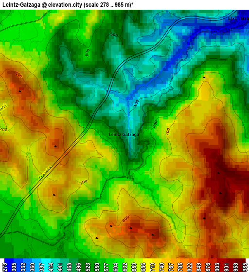
Below is the Elevation map of Leintz-Gatzaga, which displays elevation range with different colors. Scale of the first map is from 278 to 985 m (912 to 3232 ft) with average elevation of 634.7 meters (=2082 ft) [note 1]
These maps also provides idea of topography and contour of this city, they are displayed at different zoom levels. More info about maps, scale and edge coordinates you can find below images.
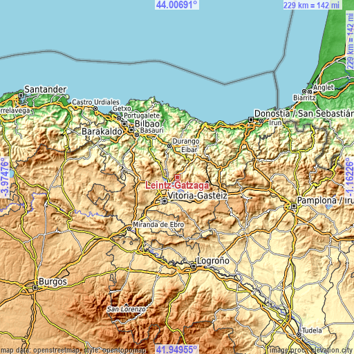
| \ | Map #1 | Topo.Map |
| Scale [m] | 278..985 m | × |
| Scale [ft] | 912..3232 ft | × |
| Average | 634.7 m = 2082 ft | × |
| Width | 7.15 km = 4.4 mi | 228.8 km = 142.2 mi |
| Height | 7.15 km = 4.4 mi | 228.7 km = 142.1 mi |
| ↑Max Latitude | 43.018978° | 44.00691° |
| Latitude at center | 42.98684° | 42.98684° |
| ↓Min Latitude | 42.954685° | 41.94955° |
| ← Min Longitude | -2.612455° | -3.97476° |
| Longitude center | -2.56851° | -2.56851° |
| →Max Longitude | -2.524565° | -1.16226° |
Nearby cities:
Cities around Leintz-Gatzaga sort by population:
• Gasteiz / Vitoria elevation 547 m
17.4 km,  209°
209°
• Arrasate / Mondragón 211 m
10.7 km,  36°
36°
• Bergara 157 m
18.8 km, 40°
• Oñati 248 m
13.9 km,  68°
68°
• Elorrio 192 m
16 km,  8°
8°
• Aretxabaleta 246 m
7.4 km, 44°
• Eskoriatza 284 m
4.9 km, 44°
• Mañaria 194 m
18.4 km,  335°
335°
• Abadiño 137 m
18.6 km,  349°
349°
• Elgeta 464 m
17.9 km,  21°
21°
• Ubide 571 m
10.5 km,  293°
293°
• Otxandio 580 m
8.4 km,  307°
307°
Multilingual:
 En español:
Salinas de Léniz elevación 457 m.
 En France:
Leintz-Gatzaga élévation 457 m.
 Auf Deutsch:
Leintz-Gatzaga höhe über dem Meeresspiegel ist 457 m.

Sources and notes:
- [note 1] Map square and city borders are not equal. Map elevation data is calculated only from area inside that square.
- [src 1] Elevation data from geonames database provided with same terms of usage.
- [src 2] The elevation map of Leintz-Gatzaga is generated using elevation data from NASA's 3 arcsec (90m) resolution SRTM data.
- [src 3] Base (background) map © OpenStreetMap contributors tiles are generated by Geofabrik and OpenTopoMap.
Copyright & License:
This Leintz-Gatzaga Elevation Map is licensed under CC BY-SA. You may reuse any part from this page, if you give a proper credit by linking to this URL:
 More info on terms of use page.