Otxandio elevation
Otxandio (Basque Country, Bizkaia), Spain elevation is 580 meters and Otxandio elevation in feet is 1903 ft above sea level [src 1]. Otxandio is a seat of a third-order administrative division (feature code) with elevation that is 23 meters (75 ft) smaller than average city elevation in Spain.
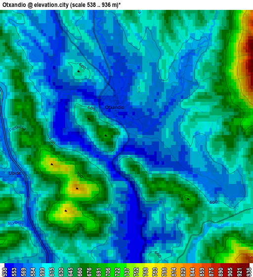
Below is the Elevation map of Otxandio, which displays elevation range with different colors. Scale of the first map is from 538 to 936 m (1765 to 3071 ft) with average elevation of 619.7 meters (=2033 ft) [note 1]
These maps also provides idea of topography and contour of this city, they are displayed at different zoom levels. More info about maps, scale and edge coordinates you can find below images.
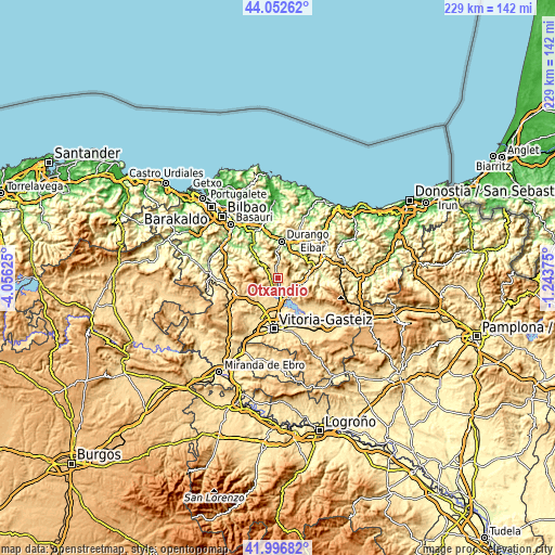
| \ | Map #1 | Topo.Map |
| Scale [m] | 538..936 m | × |
| Scale [ft] | 1765..3071 ft | × |
| Average | 619.7 m = 2033 ft | × |
| Width | 7.14 km = 4.4 mi | 228.6 km = 142 mi |
| Height | 7.14 km = 4.4 mi | 228.6 km = 142 mi |
| ↑Max Latitude | 43.065444° | 44.05262° |
| Latitude at center | 43.03333° | 43.03333° |
| ↓Min Latitude | 43.001199° | 41.99682° |
| ← Min Longitude | -2.693945° | -4.05625° |
| Longitude center | -2.65° | -2.65° |
| →Max Longitude | -2.606055° | -1.24375° |
Nearby cities:
Cities around Otxandio sort by population:
• Durango elevation 116 m
15.4 km,  4°
4°
• Arrasate / Mondragón 211 m
13.5 km,  75°
75°
• Elorrio 192 m
13.9 km,  39°
39°
• Aretxabaleta 246 m
11.8 km,  89°
89°
• Eskoriatza 284 m
10.2 km,  99°
99°
• Zeanuri 168 m
11 km,  312°
312°
• Mañaria 194 m
11.7 km,  355°
355°
• Izurtza 286 m
13 km,  5°
5°
• Abadiño 137 m
13.5 km, 14°
• Areatza 141 m
13.3 km, 314°
• Leintz-Gatzaga 457 m
8.4 km,  127°
127°
• Ubide 571 m
3.2 km,  251°
251°
Multilingual:
 En español:
Ochandiano elevación 580 m.
 En France:
Otxandio élévation 580 m.
 Auf Deutsch:
Otxandio höhe über dem Meeresspiegel ist 580 m.

Sources and notes:
- [note 1] Map square and city borders are not equal. Map elevation data is calculated only from area inside that square.
- [src 1] Elevation data from geonames database provided with same terms of usage.
- [src 2] The elevation map of Otxandio is generated using elevation data from NASA's 3 arcsec (90m) resolution SRTM data.
- [src 3] Base (background) map © OpenStreetMap contributors tiles are generated by Geofabrik and OpenTopoMap.
Copyright & License:
This Otxandio Elevation Map is licensed under CC BY-SA. You may reuse any part from this page, if you give a proper credit by linking to this URL:
 More info on terms of use page.