Pelarrodríguez elevation
Pelarrodríguez (Castille and León, Provincia de Salamanca), Spain elevation is 756 meters and Pelarrodríguez elevation in feet is 2480 ft above sea level [src 1]. Pelarrodríguez is a seat of a third-order administrative division (feature code) with elevation that is 153 meters (502 ft) bigger than average city elevation in Spain.
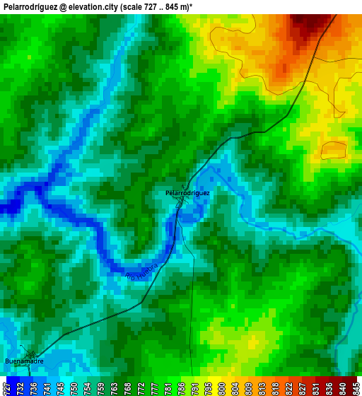
Below is the Elevation map of Pelarrodríguez, which displays elevation range with different colors. Scale of the first map is from 727 to 845 m (2385 to 2772 ft) with average elevation of 768.6 meters (=2522 ft) [note 1]
These maps also provides idea of topography and contour of this city, they are displayed at different zoom levels. More info about maps, scale and edge coordinates you can find below images.
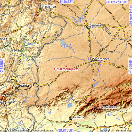
| \ | Map #1 | Topo.Map |
| Scale [m] | 727..845 m | × |
| Scale [ft] | 2385..2772 ft | × |
| Average | 768.6 m = 2522 ft | × |
| Width | 7.39 km = 4.6 mi | 236.4 km = 146.9 mi |
| Height | 7.39 km = 4.6 mi | 236.4 km = 146.9 mi |
| ↑Max Latitude | 40.920444° | 41.9418° |
| Latitude at center | 40.88723° | 40.88723° |
| ↓Min Latitude | 40.853999° | 39.81558° |
| ← Min Longitude | -6.256655° | -7.61896° |
| Longitude center | -6.21271° | -6.21271° |
| →Max Longitude | -6.168765° | -4.80646° |
Nearby cities:
Cities around Pelarrodríguez sort by population:
• La Fuente de San Esteban elevation 770 m
10.3 km,  202°
202°
• Martín de Yeltes 764 m
14 km,  208°
208°
• Cipérez 767 m
9.4 km,  331°
331°
• Boada 780 m
11.2 km,  224°
224°
• Aldehuela de la Bóveda 784 m
14.1 km,  106°
106°
• San Muñoz 782 m
13.6 km,  148°
148°
• Retortillo 736 m
15.6 km,  232°
232°
• Sando 839 m
12.4 km,  43°
43°
• Santa María de Sando 825 m
12.4 km,  34°
34°
• Buenamadre 757 m
4.6 km, 222°
• Garcirrey 811 m
7 km,  77°
77°
• Villasdardo 812 m
13.7 km,  17°
17°
Multilingual:
 En español:
Pelarrodríguez elevación 756 m.
 En France:
Pelarrodríguez élévation 756 m.
 Auf Deutsch:
Pelarrodríguez höhe über dem Meeresspiegel ist 756 m.

Sources and notes:
- [note 1] Map square and city borders are not equal. Map elevation data is calculated only from area inside that square.
- [src 1] Elevation data from geonames database provided with same terms of usage.
- [src 2] The elevation map of Pelarrodríguez is generated using elevation data from NASA's 3 arcsec (90m) resolution SRTM data.
- [src 3] Base (background) map © OpenStreetMap contributors tiles are generated by Geofabrik and OpenTopoMap.
Copyright & License:
This Pelarrodríguez Elevation Map is licensed under CC BY-SA. You may reuse any part from this page, if you give a proper credit by linking to this URL:
 More info on terms of use page.