Taboada elevation
Taboada (Galicia, Provincia de Lugo), Spain elevation is 623 meters and Taboada elevation in feet is 2044 ft above sea level [src 1]. Taboada is a populated place (feature code) with elevation that is 20 meters (66 ft) bigger than average city elevation in Spain.
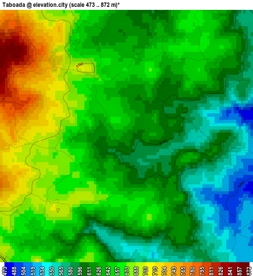
Below is the Elevation map of Taboada, which displays elevation range with different colors. Scale of the first map is from 473 to 872 m (1552 to 2861 ft) with average elevation of 638.3 meters (=2094 ft) [note 1]
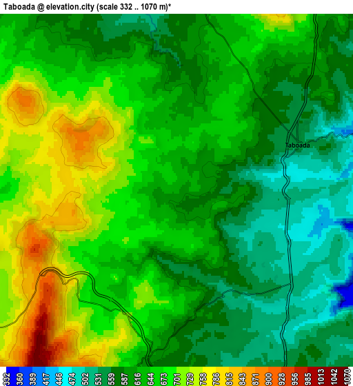
These maps also provides idea of topography and contour of this city, they are displayed at different zoom levels. More info about maps, scale and edge coordinates you can find below images.
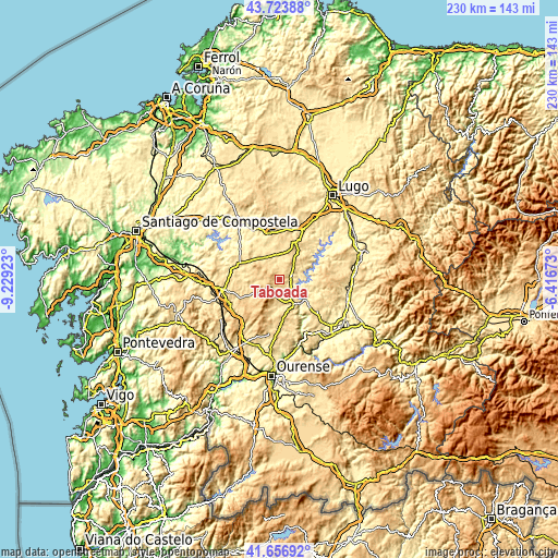
| \ | Map #1 | Map #2 | Topo.Map |
| Scale [m] | 473..872 m | 332..1070 m | × |
| Scale [ft] | 1552..2861 ft | 1089..3510 ft | × |
| Average | 638.3 m = 2094 ft | 636.7 m = 2089 ft | × |
| Width | 7.18 km = 4.5 mi | 14.36 km = 8.9 mi | 229.8 km = 142.8 mi |
| Height | 7.18 km = 4.5 mi | 14.36 km = 8.9 mi | 229.8 km = 142.8 mi |
| ↑Max Latitude | 42.731288° | 42.76356° | 43.72388° |
| Latitude at center | 42.699° | 42.699° | 42.699° |
| ↓Min Latitude | 42.666695° | 42.634373° | 41.65692° |
| ← Min Longitude | -7.866925° | -7.910871° | -9.22923° |
| Longitude center | -7.82298° | -7.82298° | -7.82298° |
| →Max Longitude | -7.779035° | -7.735089° | -6.41673° |
Nearby cities:
Cities around Taboada sort by population:
• Lalín elevation 552 m
24.1 km,  259°
259°
• Chantada 491 m
10.9 km,  157°
157°
• Castro 667 m
21 km,  68°
68°
• Monterroso 549 m
10.4 km,  354°
354°
• Rodeiro 656 m
12 km,  244°
244°
• Paradela 606 m
22.2 km, 70°
• Dozón 722 m
20.4 km,  230°
230°
• Ourol 465 m
25.5 km,  41°
41°
• Piñor 547 m
26.4 km,  213°
213°
• Guntín 445 m
23.5 km,  26°
26°
• Portomarín 367 m
20.7 km,  54°
54°
• Carballedo 575 m
19.7 km,  181°
181°
Multilingual:
 En español:
Taboada elevación 623 m.
 En France:
Taboada élévation 623 m.


Sources and notes:
- [note 1] Map square and city borders are not equal. Map elevation data is calculated only from area inside that square.
- [src 1] Elevation data from geonames database provided with same terms of usage.
- [src 2] The elevation map of Taboada is generated using elevation data from NASA's 3 arcsec (90m) resolution SRTM data.
- [src 3] Base (background) map © OpenStreetMap contributors tiles are generated by Geofabrik and OpenTopoMap.
Copyright & License:
This Taboada Elevation Map is licensed under CC BY-SA. You may reuse any part from this page, if you give a proper credit by linking to this URL:
 More info on terms of use page.