Belgern elevation
Belgern (Saxony), Germany elevation is 113 meters and Belgern elevation in feet is 371 ft above sea level [src 1]. Belgern is a populated place (feature code) with elevation that is 145 meters (476 ft) smaller than average city elevation in Germany.
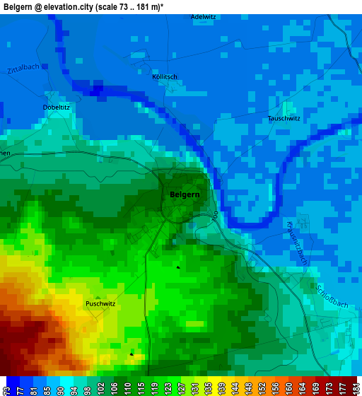
Below is the Elevation map of Belgern, which displays elevation range with different colors. Scale of the first map is from 73 to 181 m (240 to 594 ft) with average elevation of 100.7 meters (=330 ft) [note 1]
These maps also provides idea of topography and contour of this city, they are displayed at different zoom levels. More info about maps, scale and edge coordinates you can find below images.
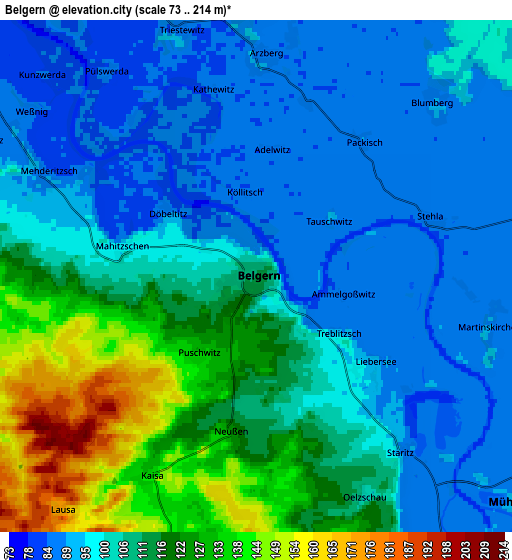
| \ | Map #1 | Map #2 | Topo.Map |
| Scale [m] | 73..181 m | 73..214 m | × |
| Scale [ft] | 240..594 ft | 240..702 ft | × |
| Average | 100.7 m = 330 ft | 105.3 m = 345 ft | × |
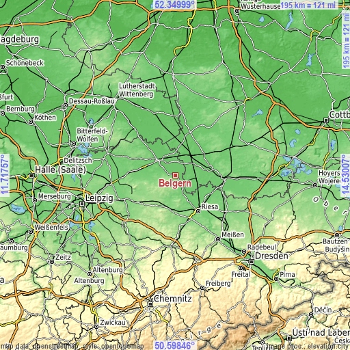
| Width | 6.09 km = 3.8 mi | 12.17 km = 7.6 mi | 194.8 km = 121 mi |
| Height | 6.09 km = 3.8 mi | 12.17 km = 7.6 mi | 194.7 km = 121 mi |
| ↑Max Latitude | 51.509989° | 51.537331° | 52.34999° |
| Latitude at center | 51.48263° | 51.48263° | 51.48263° |
| ↓Min Latitude | 51.455255° | 51.427863° | 50.59846° |
| ← Min Longitude | 13.079875° | 13.035929° | 11.71757° |
| Longitude center | 13.12382° | 13.12382° | 13.12382° |
| →Max Longitude | 13.167765° | 13.211711° | 14.53007° |
Nearby cities:
Cities around Belgern sort by population:
• Torgau elevation 89 m
12.3 km,  314°
314°
• Bad Liebenwerda 89 m
19.2 km,  78°
78°
• Falkenberg 88 m
14.1 km,  35°
35°
• Dahlen 146 m
15.7 km,  213°
213°
• Mühlberg 93 m
8.6 km,  128°
128°
• Strehla 118 m
16.1 km,  153°
153°
• Schildau 119 m
13.7 km,  258°
258°
• Beilrode 81 m
10.1 km,  337°
337°
• Cavertitz 101 m
11.1 km,  176°
176°
• Arzberg 87 m
5.1 km,  1°
1°
• Uebigau 87 m
17.4 km, 44°
• Zinna 100 m
15.1 km, 308°
Multilingual:
 En español:
Belgern elevación 113 m.
 En France:
Belgern élévation 113 m.


Sources and notes:
- [note 1] Map square and city borders are not equal. Map elevation data is calculated only from area inside that square.
- [src 1] Elevation data from geonames database provided with same terms of usage.
- [src 2] The elevation map of Belgern is generated using elevation data from NASA's 3 arcsec (90m) resolution SRTM data.
- [src 3] Base (background) map © OpenStreetMap contributors tiles are generated by Geofabrik and OpenTopoMap.
Copyright & License:
This Belgern Elevation Map is licensed under CC BY-SA. You may reuse any part from this page, if you give a proper credit by linking to this URL:
 More info on terms of use page.