Mühlberg elevation
Mühlberg (Brandenburg), Germany elevation is 93 meters and Mühlberg elevation in feet is 305 ft above sea level [src 1]. Mühlberg is a populated place (feature code) with elevation that is 165 meters (541 ft) smaller than average city elevation in Germany.
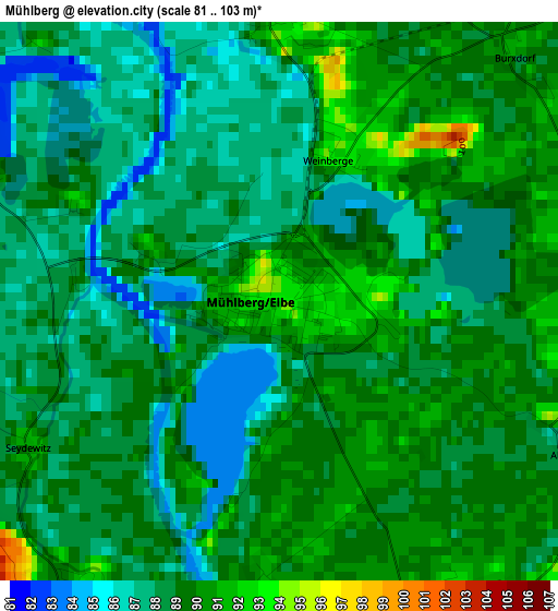
Below is the Elevation map of Mühlberg, which displays elevation range with different colors. Scale of the first map is from 81 to 103 m (266 to 338 ft) with average elevation of 88.5 meters (=290 ft) [note 1]
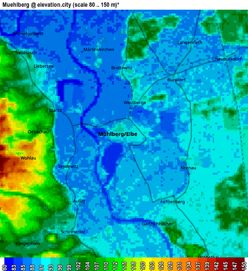
These maps also provides idea of topography and contour of this city, they are displayed at different zoom levels. More info about maps, scale and edge coordinates you can find below images.
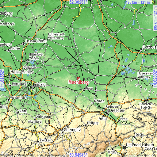
| \ | Map #1 | Map #2 | Topo.Map |
| Scale [m] | 81..103 m | 80..150 m | × |
| Scale [ft] | 266..338 ft | 262..492 ft | × |
| Average | 88.5 m = 290 ft | 94.5 m = 310 ft | × |
| Width | 6.09 km = 3.8 mi | 12.18 km = 7.6 mi | 195 km = 121.2 mi |
| Height | 6.09 km = 3.8 mi | 12.18 km = 7.6 mi | 194.9 km = 121.1 mi |
| ↑Max Latitude | 51.461918° | 51.489289° | 52.30281° |
| Latitude at center | 51.43453° | 51.43453° | 51.43453° |
| ↓Min Latitude | 51.407126° | 51.379705° | 50.54943° |
| ← Min Longitude | 13.177825° | 13.133879° | 11.81552° |
| Longitude center | 13.22177° | 13.22177° | 13.22177° |
| →Max Longitude | 13.265715° | 13.309661° | 14.62802° |
Nearby cities:
Cities around Mühlberg sort by population:
• Riesa elevation 111 m
14.9 km,  161°
161°
• Oschatz 124 m
16.9 km,  207°
207°
• Bad Liebenwerda 89 m
15.2 km,  52°
52°
• Falkenberg 88 m
16.9 km,  5°
5°
• Zeithain 98 m
13.8 km,  144°
144°
• Belgern 113 m
8.6 km,  308°
308°
• Strehla 118 m
9.1 km,  177°
177°
• Cavertitz 101 m
8.4 km,  227°
227°
• Arzberg 87 m
12.4 km,  327°
327°
• Glaubitz 99 m
16.3 km, 138°
• Wülknitz 97 m
14.5 km,  121°
121°
• Nauwalde 94 m
13.2 km,  97°
97°
Multilingual:
 En español:
Mühlberg elevación 93 m.
 En France:
Mühlberg élévation 93 m.
 Auf Deutsch:
Mühlberg/Elbe höhe über dem Meeresspiegel ist 93 m.

Sources and notes:
- [note 1] Map square and city borders are not equal. Map elevation data is calculated only from area inside that square.
- [src 1] Elevation data from geonames database provided with same terms of usage.
- [src 2] The elevation map of Mühlberg is generated using elevation data from NASA's 3 arcsec (90m) resolution SRTM data.
- [src 3] Base (background) map © OpenStreetMap contributors tiles are generated by Geofabrik and OpenTopoMap.
Copyright & License:
This Mühlberg Elevation Map is licensed under CC BY-SA. You may reuse any part from this page, if you give a proper credit by linking to this URL:
 More info on terms of use page.