Zeithain elevation
Zeithain (Saxony), Germany elevation is 98 meters and Zeithain elevation in feet is 322 ft above sea level [src 1]. Zeithain is a seat of a fourth-order administrative division (feature code) with elevation that is 160 meters (525 ft) smaller than average city elevation in Germany.
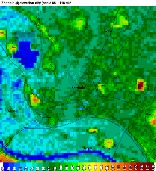
Below is the Elevation map of Zeithain, which displays elevation range with different colors. Scale of the first map is from 88 to 118 m (289 to 387 ft) with average elevation of 96.5 meters (=317 ft) [note 1]
These maps also provides idea of topography and contour of this city, they are displayed at different zoom levels. More info about maps, scale and edge coordinates you can find below images.
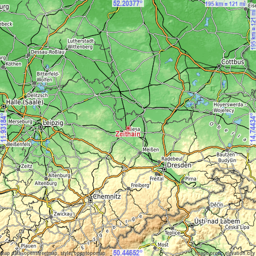
| \ | Map #1 | Map #2 | Topo.Map |
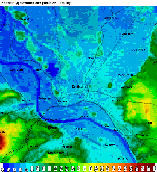
| Scale [m] | 88..118 m | 86..160 m | × |
| Scale [ft] | 289..387 ft | 282..525 ft | × |
| Average | 96.5 m = 317 ft | 101.3 m = 332 ft | × |
| Width | 6.11 km = 3.8 mi | 12.21 km = 7.6 mi | 195.4 km = 121.4 mi |
| Height | 6.11 km = 3.8 mi | 12.21 km = 7.6 mi | 195.4 km = 121.4 mi |
| ↑Max Latitude | 51.361008° | 51.38844° | 52.20377° |
| Latitude at center | 51.33356° | 51.33356° | 51.33356° |
| ↓Min Latitude | 51.306095° | 51.278614° | 50.44652° |
| ← Min Longitude | 13.294145° | 13.250199° | 11.93184° |
| Longitude center | 13.33809° | 13.33809° | 13.33809° |
| →Max Longitude | 13.382035° | 13.425981° | 14.74434° |
Nearby cities:
Cities around Zeithain sort by population:
• Riesa elevation 111 m
4.3 km,  228°
228°
• Großenhain 118 m
14.4 km,  109°
109°
• Nünchritz 100 m
5 km,  138°
138°
• Mühlberg 93 m
13.8 km,  324°
324°
• Strehla 118 m
8 km,  285°
285°
• Stauchitz 126 m
13.2 km,  220°
220°
• Zabeltitz 111 m
11.7 km,  80°
80°
• Glaubitz 99 m
2.9 km, 108°
• Wülknitz 97 m
5.7 km,  49°
49°
• Wildenhain 114 m
10.1 km, 106°
• Nauwalde 94 m
10.7 km,  27°
27°
• Weißig 124 m
8.5 km,  122°
122°
Multilingual:
 En español:
Zeithain elevación 98 m.
 En France:
Zeithain élévation 98 m.


Sources and notes:
- [note 1] Map square and city borders are not equal. Map elevation data is calculated only from area inside that square.
- [src 1] Elevation data from geonames database provided with same terms of usage.
- [src 2] The elevation map of Zeithain is generated using elevation data from NASA's 3 arcsec (90m) resolution SRTM data.
- [src 3] Base (background) map © OpenStreetMap contributors tiles are generated by Geofabrik and OpenTopoMap.
Copyright & License:
This Zeithain Elevation Map is licensed under CC BY-SA. You may reuse any part from this page, if you give a proper credit by linking to this URL:
 More info on terms of use page.