Schildau elevation
Schildau (Saxony), Germany elevation is 119 meters and Schildau elevation in feet is 390 ft above sea level [src 1]. Schildau is a populated place (feature code) with elevation that is 139 meters (456 ft) smaller than average city elevation in Germany.
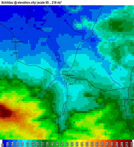
Below is the Elevation map of Schildau, which displays elevation range with different colors. Scale of the first map is from 95 to 218 m (312 to 715 ft) with average elevation of 126.5 meters (=415 ft) [note 1]
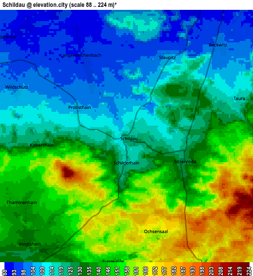
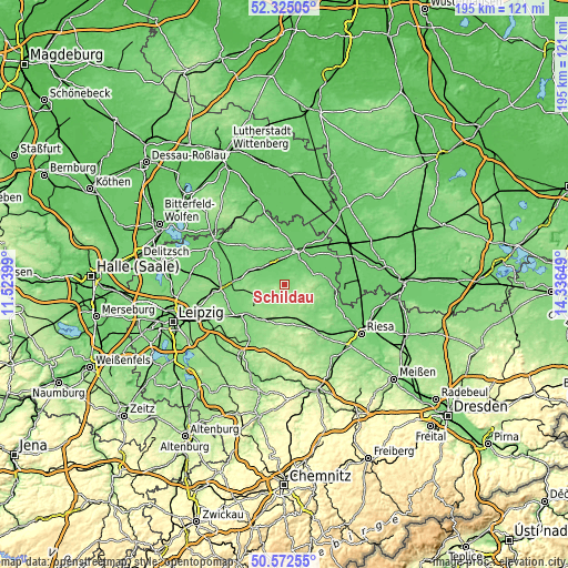
These maps also provides idea of topography and contour of this city, they are displayed at different zoom levels. More info about maps, scale and edge coordinates you can find below images.
| \ | Map #1 | Map #2 | Topo.Map |
| Scale [m] | 95..218 m | 88..224 m | × |
| Scale [ft] | 312..715 ft | 289..735 ft | × |
| Average | 126.5 m = 415 ft | 130.9 m = 429 ft | × |
| Width | 6.09 km = 3.8 mi | 12.18 km = 7.6 mi | 194.9 km = 121.1 mi |
| Height | 6.09 km = 3.8 mi | 12.18 km = 7.6 mi | 194.8 km = 121 mi |
| ↑Max Latitude | 51.484584° | 51.511942° | 52.32505° |
| Latitude at center | 51.45721° | 51.45721° | 51.45721° |
| ↓Min Latitude | 51.42982° | 51.402413° | 50.57255° |
| ← Min Longitude | 12.886295° | 12.842349° | 11.52399° |
| Longitude center | 12.93024° | 12.93024° | 12.93024° |
| →Max Longitude | 12.974185° | 13.018131° | 14.33649° |
Nearby cities:
Cities around Schildau sort by population:
• Torgau elevation 89 m
12.3 km,  21°
21°
• Wurzen 126 m
16.4 km,  233°
233°
• Mockrehna 104 m
9.8 km,  304°
304°
• Dahlen 146 m
11.3 km,  155°
155°
• Belgern 113 m
13.7 km,  78°
78°
• Doberschütz 106 m
13.4 km,  290°
290°
• Falkenhain 135 m
7.7 km,  212°
212°
• Hohburg 127 m
10 km,  239°
239°
• Beilrode 81 m
15.4 km,  37°
37°
• Cavertitz 101 m
16.3 km,  120°
120°
• Arzberg 87 m
15.7 km,  59°
59°
• Zinna 100 m
12.4 km,  7°
7°
Multilingual:
 En español:
Schildau elevación 119 m.
 En France:
Schildau élévation 119 m.
 Auf Deutsch:
Schildau höhe über dem Meeresspiegel ist 119 m.

Sources and notes:
- [note 1] Map square and city borders are not equal. Map elevation data is calculated only from area inside that square.
- [src 1] Elevation data from geonames database provided with same terms of usage.
- [src 2] The elevation map of Schildau is generated using elevation data from NASA's 3 arcsec (90m) resolution SRTM data.
- [src 3] Base (background) map © OpenStreetMap contributors tiles are generated by Geofabrik and OpenTopoMap.
Copyright & License:
This Schildau Elevation Map is licensed under CC BY-SA. You may reuse any part from this page, if you give a proper credit by linking to this URL:
 More info on terms of use page.