Torgau elevation
Torgau (Saxony), Germany elevation is 89 meters and Torgau elevation in feet is 292 ft above sea level [src 1]. Torgau is a seat of a third-order administrative division (feature code) with elevation that is 169 meters (554 ft) smaller than average city elevation in Germany.
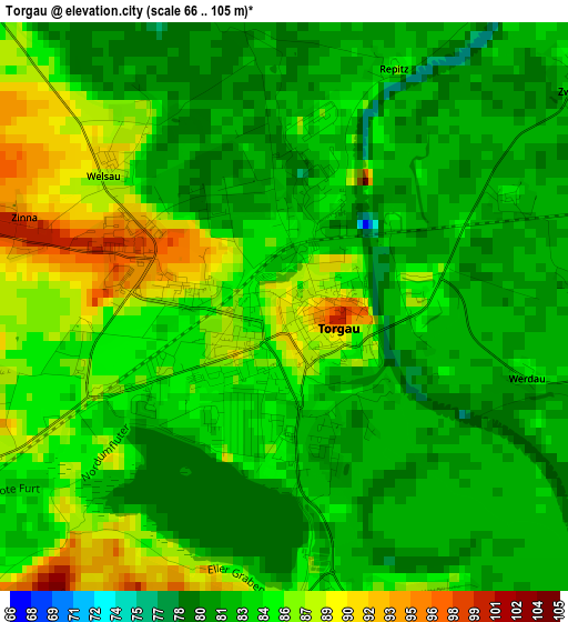
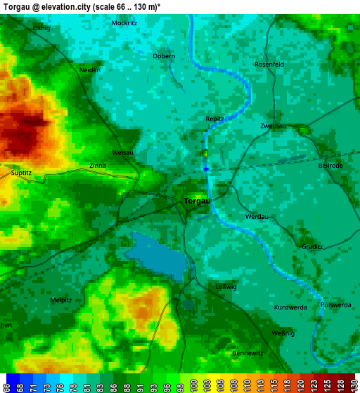
Below is the Elevation map of Torgau, which displays elevation range with different colors. Scale of the first map is from 66 to 105 m (217 to 344 ft) with average elevation of 83.4 meters (=274 ft) [note 1]
These maps also provides idea of topography and contour of this city, they are displayed at different zoom levels. More info about maps, scale and edge coordinates you can find below images.
| \ | Map #1 | Map #2 | Topo.Map |
| Scale [m] | 66..105 m | 66..130 m | × |
| Scale [ft] | 217..344 ft | 217..427 ft | × |
| Average | 83.4 m = 274 ft | 87 m = 285 ft | × |
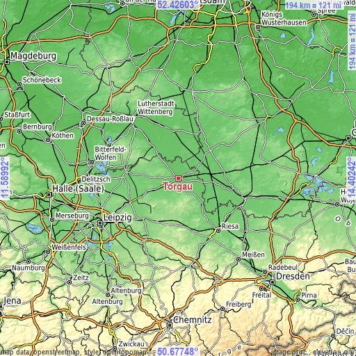
| Width | 6.08 km = 3.8 mi | 12.15 km = 7.5 mi | 194.4 km = 120.8 mi |
| Height | 6.08 km = 3.8 mi | 12.15 km = 7.5 mi | 194.4 km = 120.8 mi |
| ↑Max Latitude | 51.587472° | 51.614768° | 52.42603° |
| Latitude at center | 51.56016° | 51.56016° | 51.56016° |
| ↓Min Latitude | 51.532831° | 51.505486° | 50.67748° |
| ← Min Longitude | 12.952225° | 12.908279° | 11.58992° |
| Longitude center | 12.99617° | 12.99617° | 12.99617° |
| →Max Longitude | 13.040115° | 13.084061° | 14.40242° |
Nearby cities:
Cities around Torgau sort by population:
• Falkenberg elevation 88 m
17.3 km,  80°
80°
• Mockrehna 104 m
13.9 km,  245°
245°
• Belgern 113 m
12.3 km,  134°
134°
• Doberschütz 106 m
18.5 km, 248°
• Schildau 119 m
12.3 km,  201°
201°
• Dommitzsch 82 m
12.1 km,  317°
317°
• Beilrode 81 m
4.9 km, 81°
• Arzberg 87 m
9.6 km,  111°
111°
• Prettin 81 m
12.3 km,  335°
335°
• Zinna 100 m
3.1 km,  286°
286°
• Elsnig 84 m
7.3 km, 319°
• Trossin 112 m
13.9 km,  296°
296°
Multilingual:
 En español:
Torgau elevación 89 m.
 En France:
Torgau élévation 89 m.


Sources and notes:
- [note 1] Map square and city borders are not equal. Map elevation data is calculated only from area inside that square.
- [src 1] Elevation data from geonames database provided with same terms of usage.
- [src 2] The elevation map of Torgau is generated using elevation data from NASA's 3 arcsec (90m) resolution SRTM data.
- [src 3] Base (background) map © OpenStreetMap contributors tiles are generated by Geofabrik and OpenTopoMap.
Copyright & License:
This Torgau Elevation Map is licensed under CC BY-SA. You may reuse any part from this page, if you give a proper credit by linking to this URL:
 More info on terms of use page.