Greding elevation
Greding (Bavaria, Regierungsbezirk Mittelfranken), Germany elevation is 393 meters and Greding elevation in feet is 1289 ft above sea level [src 1]. Greding is a populated place (feature code) with elevation that is 135 meters (443 ft) bigger than average city elevation in Germany.
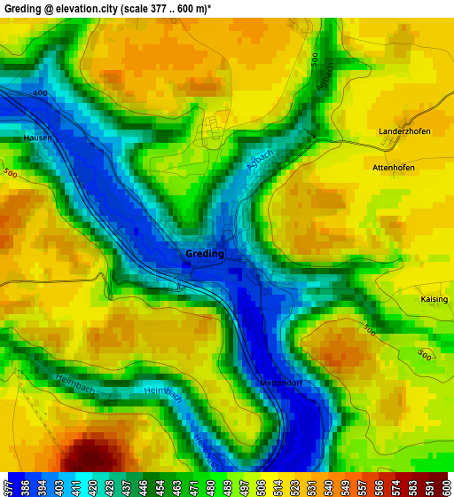
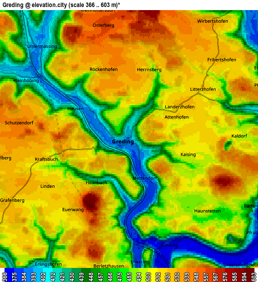
Below is the Elevation map of Greding, which displays elevation range with different colors. Scale of the first map is from 377 to 600 m (1237 to 1969 ft) with average elevation of 483.2 meters (=1585 ft) [note 1]
These maps also provides idea of topography and contour of this city, they are displayed at different zoom levels. More info about maps, scale and edge coordinates you can find below images.
| \ | Map #1 | Map #2 | Topo.Map |
| Scale [m] | 377..600 m | 366..603 m | × |
| Scale [ft] | 1237..1969 ft | 1201..1978 ft | × |
| Average | 483.2 m = 1585 ft | 493.8 m = 1620 ft | × |
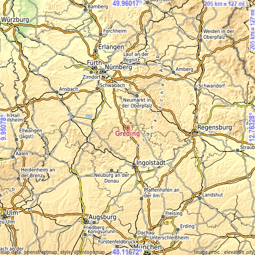
| Width | 6.41 km = 4 mi | 12.81 km = 8 mi | 205 km = 127.4 mi |
| Height | 6.41 km = 4 mi | 12.81 km = 8 mi | 205 km = 127.4 mi |
| ↑Max Latitude | 49.075785° | 49.104564° | 49.96017° |
| Latitude at center | 49.04699° | 49.04699° | 49.04699° |
| ↓Min Latitude | 49.018178° | 48.98935° | 48.11672° |
| ← Min Longitude | 11.313085° | 11.269139° | 9.95078° |
| Longitude center | 11.35703° | 11.35703° | 11.35703° |
| →Max Longitude | 11.400975° | 11.444921° | 12.76328° |
Nearby cities:
Cities around Greding sort by population:
• Eichstätt elevation 397 m
21.1 km,  213°
213°
• Hilpoltstein 377 m
20 km,  322°
322°
• Berching 387 m
9.1 km,  42°
42°
• Freystadt 407 m
17.1 km,  353°
353°
• Dietfurt 365 m
16.8 km,  94°
94°
• Thalmässing 415 m
10.9 km,  294°
294°
• Heideck 406 m
19.3 km,  299°
299°
• Sengenthal 476 m
22.2 km,  21°
21°
• Nennslingen 524 m
16.5 km,  270°
270°
• Burgsalach 584 m
19 km, 265°
• Raitenbuch 561 m
17.3 km,  258°
258°
• Bergen 540 m
17.9 km,  279°
279°
Multilingual:
 En español:
Greding elevación 393 m.
 En France:
Greding élévation 393 m.


Sources and notes:
- [note 1] Map square and city borders are not equal. Map elevation data is calculated only from area inside that square.
- [src 1] Elevation data from geonames database provided with same terms of usage.
- [src 2] The elevation map of Greding is generated using elevation data from NASA's 3 arcsec (90m) resolution SRTM data.
- [src 3] Base (background) map © OpenStreetMap contributors tiles are generated by Geofabrik and OpenTopoMap.
Copyright & License:
This Greding Elevation Map is licensed under CC BY-SA. You may reuse any part from this page, if you give a proper credit by linking to this URL:
 More info on terms of use page.