Freystadt elevation
Freystadt (Bavaria, Upper Palatinate), Germany elevation is 407 meters and Freystadt elevation in feet is 1335 ft above sea level [src 1]. Freystadt is a populated place (feature code) with elevation that is 149 meters (489 ft) bigger than average city elevation in Germany.
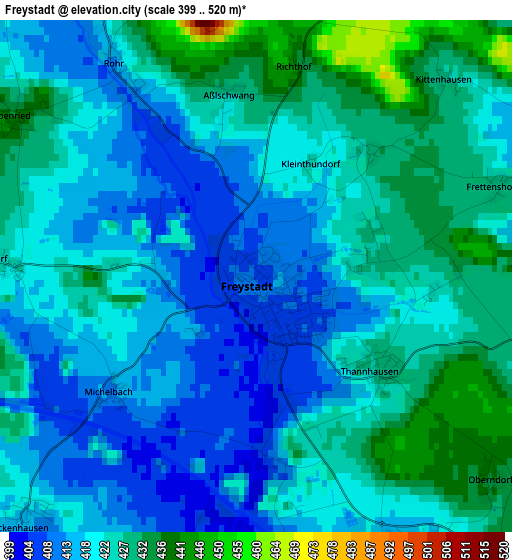
Below is the Elevation map of Freystadt, which displays elevation range with different colors. Scale of the first map is from 399 to 520 m (1309 to 1706 ft) with average elevation of 421.5 meters (=1383 ft) [note 1]
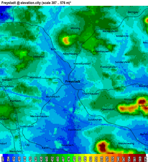
These maps also provides idea of topography and contour of this city, they are displayed at different zoom levels. More info about maps, scale and edge coordinates you can find below images.
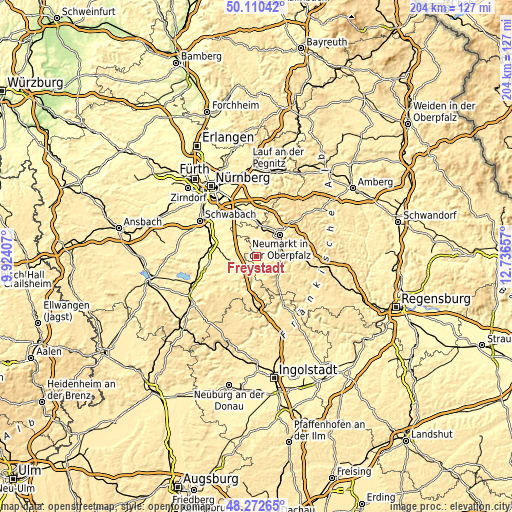
| \ | Map #1 | Map #2 | Topo.Map |
| Scale [m] | 399..520 m | 387..576 m | × |
| Scale [ft] | 1309..1706 ft | 1270..1890 ft | × |
| Average | 421.5 m = 1383 ft | 427.6 m = 1403 ft | × |
| Width | 6.39 km = 4 mi | 12.77 km = 7.9 mi | 204.3 km = 126.9 mi |
| Height | 6.39 km = 4 mi | 12.77 km = 7.9 mi | 204.3 km = 126.9 mi |
| ↑Max Latitude | 49.228776° | 49.257466° | 50.11042° |
| Latitude at center | 49.20007° | 49.20007° | 49.20007° |
| ↓Min Latitude | 49.171347° | 49.142607° | 48.27265° |
| ← Min Longitude | 11.286375° | 11.242429° | 9.92407° |
| Longitude center | 11.33032° | 11.33032° | 11.33032° |
| →Max Longitude | 11.374265° | 11.418211° | 12.73657° |
Nearby cities:
Cities around Freystadt sort by population:
• Neumarkt in der Oberpfalz elevation 431 m
13.1 km,  47°
47°
• Hilpoltstein 377 m
10.2 km,  263°
263°
• Burgthann 431 m
17 km,  355°
355°
• Berching 387 m
13.1 km,  142°
142°
• Allersberg 387 m
8.9 km,  309°
309°
• Postbauer-Heng 460 m
11.9 km,  9°
9°
• Pyrbaum 439 m
11.2 km,  343°
343°
• Thalmässing 415 m
14.7 km,  212°
212°
• Heideck 406 m
16.5 km,  243°
243°
• Deining 472 m
15.5 km,  79°
79°
• Sengenthal 476 m
10.6 km,  69°
69°
• Berngau 431 m
7.5 km,  42°
42°
Multilingual:
 En español:
Freystadt elevación 407 m.
 En France:
Freystadt élévation 407 m.
 Auf Deutsch:
Freystadt höhe über dem Meeresspiegel ist 407 m.

Sources and notes:
- [note 1] Map square and city borders are not equal. Map elevation data is calculated only from area inside that square.
- [src 1] Elevation data from geonames database provided with same terms of usage.
- [src 2] The elevation map of Freystadt is generated using elevation data from NASA's 3 arcsec (90m) resolution SRTM data.
- [src 3] Base (background) map © OpenStreetMap contributors tiles are generated by Geofabrik and OpenTopoMap.
Copyright & License:
This Freystadt Elevation Map is licensed under CC BY-SA. You may reuse any part from this page, if you give a proper credit by linking to this URL:
 More info on terms of use page.