Hilpoltstein elevation
Hilpoltstein (Bavaria, Regierungsbezirk Mittelfranken), Germany elevation is 377 meters and Hilpoltstein elevation in feet is 1237 ft above sea level [src 1]. Hilpoltstein is a populated place (feature code) with elevation that is 119 meters (390 ft) bigger than average city elevation in Germany.
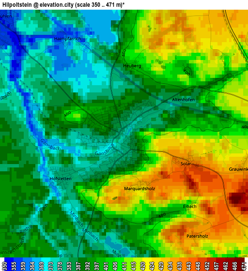
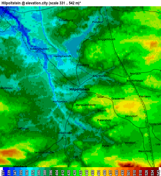
Below is the Elevation map of Hilpoltstein, which displays elevation range with different colors. Scale of the first map is from 350 to 471 m (1148 to 1545 ft) with average elevation of 398.9 meters (=1309 ft) [note 1]
These maps also provides idea of topography and contour of this city, they are displayed at different zoom levels. More info about maps, scale and edge coordinates you can find below images.
| \ | Map #1 | Map #2 | Topo.Map |
| Scale [m] | 350..471 m | 331..542 m | × |
| Scale [ft] | 1148..1545 ft | 1086..1778 ft | × |
| Average | 398.9 m = 1309 ft | 407.1 m = 1336 ft | × |
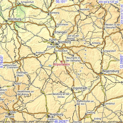
| Width | 6.39 km = 4 mi | 12.77 km = 7.9 mi | 204.4 km = 127 mi |
| Height | 6.39 km = 4 mi | 12.77 km = 7.9 mi | 204.4 km = 127 mi |
| ↑Max Latitude | 49.219182° | 49.247877° | 50.101° |
| Latitude at center | 49.19047° | 49.19047° | 49.19047° |
| ↓Min Latitude | 49.161741° | 49.132996° | 48.26287° |
| ← Min Longitude | 11.146655° | 11.102709° | 9.78435° |
| Longitude center | 11.1906° | 11.1906° | 11.1906° |
| →Max Longitude | 11.234545° | 11.278491° | 12.59685° |
Nearby cities:
Cities around Hilpoltstein sort by population:
• Roth elevation 334 m
9.6 km,  311°
311°
• Freystadt 407 m
10.2 km,  83°
83°
• Allersberg 387 m
7.5 km,  26°
26°
• Rednitzhembach 326 m
14.7 km,  326°
326°
• Georgensgmünd 359 m
12.6 km,  269°
269°
• Pyrbaum 439 m
13.7 km, 30°
• Thalmässing 415 m
11.6 km,  168°
168°
• Büchenbach 362 m
12.9 km, 311°
• Heideck 406 m
7.8 km,  216°
216°
• Röttenbach 373 m
12.3 km,  248°
248°
• Nennslingen 524 m
16.5 km,  195°
195°
• Bergen 540 m
14.2 km, 203°
Multilingual:
 En español:
Hilpoltstein elevación 377 m.
 En France:
Hilpoltstein élévation 377 m.
 Auf Deutsch:
Hilpoltstein höhe über dem Meeresspiegel ist 377 m.

Sources and notes:
- [note 1] Map square and city borders are not equal. Map elevation data is calculated only from area inside that square.
- [src 1] Elevation data from geonames database provided with same terms of usage.
- [src 2] The elevation map of Hilpoltstein is generated using elevation data from NASA's 3 arcsec (90m) resolution SRTM data.
- [src 3] Base (background) map © OpenStreetMap contributors tiles are generated by Geofabrik and OpenTopoMap.
Copyright & License:
This Hilpoltstein Elevation Map is licensed under CC BY-SA. You may reuse any part from this page, if you give a proper credit by linking to this URL:
 More info on terms of use page.